Share on Facebook
 Share on X
 Share by Email
 Share on Google Classroom

Lying north of mainland Canada, the Arctic Archipelago consists of 94 major islands (greater than 130 km2) and 36,469 minor islands covering a total of 1.4 million km 2. Apart from Greenland, which is almost entirely ice covered, the Canadian Arctic Archipelago forms the world's largest High Arctic land area. It contains six of the world's 30 largest islands; Baffin Island (fifth) is larger than the United Kingdom. The largest islands are Baffin, Victoria , Ellesmere, Banks, Devon, Axel Heiberg, Melville and Prince of Wales. They are separated by large channels, some of which would qualify as seas elsewhere in the world. For example, Parry Channel runs from Lancaster Sound to M’Clure Strait and divides the Queen Elizabeth Islands in the north from the rest of the archipelago, and is an important part of the Northwest Passage.
Physical Geography and Geology
The major islands in the eastern Arctic (Baffin, Devon, Ellesmere, Axel Heiberg) are mountainous, with peaks over 2,000 m. The higher land on these islands is commonly occupied by ice caps that contain most (75 per cent) of the glacier ice and the largest glaciers in Canada, and one-third of the volume of land ice worldwide, not including the ice sheets found on Greenland and Antarctica. These highland areas were the major source area for the Innuitian ice sheet during the last glaciation ( see also Innuitian Region).
These eastern islands also contain the northern extent of the Canadian Shield, which is covered in areas by fairly flat-lying Paleozoic rocks (i.e., rocks 251–542 million years old). The northern and western regions, including most of the Queen Elizabeth Islands, consist of younger, heavily folded sedimentary rocks, producing mountains on Axel Heiberg and parts of Devon and Ellesmere islands. The central and western islands are generally flat with low relief (less than 200 m), and consist of sedimentary rocks of the Arctic Platform.
This geological variety produces spectacular variations in scenery, with rugged mountains, steep-sided fjords, and high and low plains of various ages and rock types. The Canadian Shield areas contain mineral deposits (including gold and diamonds), while oil and natural gas deposits have been found in areas of sedimentary rocks, such as the Sverdrup Basin. Coal is also found in these areas and was discovered by early European explorers.
Waters
The depths of the channels between the islands range from less than 100 m to about 600 m in eastern Lancaster Sound. The continental shelf varies from over 550 m in depth in the west and north to 200 m in the east. In spite of low tidal ranges, which decrease from east to west, tidal currents can be strong in certain narrow passages, such as the Bellot, Fury and Hecla straits as well as Hell Gate.
The dominant water flow through the islands is from the Arctic Ocean southward through Nares Strait and eastward through Lancaster Sound and Fury and Hecla straits. The Arctic Ocean’s southward flow enters Baffin Bay and the eastward flow passes into Foxe Basin, Hudson Bay and Hudson Strait. The depth and extent of the channels offer commercial possibilities — for example, as a passageway for submarine tankers. The channels also pose some strategic concerns, for example, as an avenue of approach for submarines.
The sea ice cover, with an average thickness of about 1.5 to 2 m is complete in winter throughout the archipelago, with the exception of several recurring polynyas (areas of open water surrounded by sea ice), the largest of which is in northern Baffin Bay and in the southeastern Beaufort Sea. These polynyas, which freeze late and thaw early, are a focus for marine and bird life. There is evidence of early human habitation, by the early Inuit (Thule) and Dorset peoples, on the landmasses adjoining them.
The ice cover has been thinner in recent years, and it is now normal for large areas of the channels to be open in late summer to the point where cruise ships quite commonly sail through the Northwest Passage.
Biologically, the waters of the archipelago are rich in mammals and birds (in summer) and poor in fish.
Climate
By any measure, this is a truly polar environment. On the northern islands, night lasts 24 hours for three to four months in winter, and day the same period in summer. The average annual temperature may be as low as −20°C in the north and −6°C in southern Baffin Island, with extreme low temperatures in the order of −50°C. In the High Arctic islands, summer temperatures may rise above freezing for only one or two months. Annual precipitation is low, ranging from 400 mm on southern Baffin Island to less than 100 mm on central Ellesmere Island. The Queen Elizabeth Islands are a polar desert, with less than 150 mm of precipitation a year. The cold climate has led to the development of permafrost, which underlies all of the land area and exceeds 550 m in thickness in many places. Only a thin (less than 1 m) active layer melts at the surface each summer.
Climate Change
The Arctic is experiencing climate warming faster and more intensely than lower-latitude parts of the world. Changes have already been noticed in the High Arctic, including reduced sea ice. In addition, the glaciers of the archipelago are already retreating and thinning, some quite rapidly. Annual mean temperatures in the Arctic are predicted to increase by 4–7°C during this century, with the greatest warming to occur in winter (as much as 12°C according to one emissions scenario). In addition to warmer winter temperatures, precipitation could increase greatly. Summer temperatures and precipitation are also expected to increase.
Flora
The number of plant species incrementally decreases north of the mainland. Trees are absent, and the tundra vegetation consists of dwarf shrubs, forbs and sedges, as well as grasses, mosses and lichens.
There are about 270 vascular plant species, 325 mosses, around 100 liverworts and 550 to 600 lichens on the Arctic islands. Many plant species are widespread and have a circumpolar distribution.
Fauna


As in the case of plants, the number of animal species decreases north from the mainland. Some 20 species of land mammals live on the archipelago, generally in small numbers restricted to certain areas. The High Arctic islands are home to Peary caribou that are smaller and lighter in colour than the barren ground caribou. Other mammals in the archipelago include the muskox, Arctic fox, Arctic wolf, lemming and Arctic hare. More than 60 species of birds spend the summer in the High Arctic islands, while only six species overwinter there. The surrounding seas are home to the polar bear, the walrus and various types of seal and whale, including the narwhal and the beluga.
Terrestrial arthropods (e.g. insects) are also important components of the High Arctic tundra, and some 700 species have been identified in the archipelago.
History
Inuit


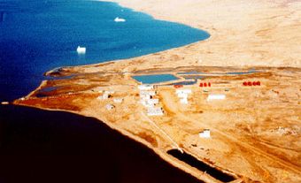
The High Arctic has been occupied by the Inuit and their predecessors for most of the past 4,000 years, and today the majority of Inuit people in Canada continue to live in the north, including in many coastal settlements scattered throughout the islands. The most northerly community in Canada is Grise Fjord on southern Ellesmere Island, which, along with Resolute on Cornwallis Island, was created in 1953 when the Canadian government forcibly relocated people from Port Harrison (now Inukjuak), Québec. Ancient links with the Greenlandic people are still maintained. Evidence has been found of contact between the Vikings, who lived in Greenland during the Middle Ages, and the islands (see Norse Voyages). The non-Inuit population is generally made up of government and military personnel in communities such as Iqaluit, Cambridge Bay Resolute and the military station at Alert.
In 1999, most of the archipelago became part of the new territory of Nunavut, which has its capital and legislature in Iqaluit on Baffin Island.
Exploration
The first Europeans to explore the seawaters of the High Arctic Archipelago were Martin Frobisher, John Davis, William Baffin and Robert Bylot. Frobisher and Davis both began by sailing the waters now named for them: Frobisher explored Frobisher Bay in 1576, while Davis sailed Davis Strait in 1585. Later, Baffin and Bylot sailed into Smith Sound and northern Baffin Bay in 1616. It was also Baffin and Bylot who first recorded Jones Sound and Lancaster Sound, later recognized as the eastern entrance to the Northwest Passage. In 1819–20 Sir William Parry sailed west as far as M’Clure Strait, where he was stopped by ice. In the 19th century, many expeditions set out to find the Northwest Passage, including that of Sir John Franklin in the 1840s. Franklin never fully navigated the passage — after becoming trapped in ice in 1846, Franklin’s two ships eventually sank. Numerous attempts to find the vessels ensued; however, it wasn’t until 2014 that one of the ships, the Erebus, was located off the coast of King William Island. ( See also Arctic Exploration Exhibit).
The Northwest Passage was finally sailed by Roald Amundsen in 1903–6 and again by Sergeant Henry Larsen of the RCMP in 1940–42 (west-east) and 1944 (east-west).
Canada began to take a systematic interest in the archipelago in the 1940s and 1950s when High Arctic Weather Stations were established, first under joint Canada–US
jurisdiction. These became focuses for government activity, including research and mapping, and for many of today’s settlements. Resolute, for example, now an Inuit community and research base for the archipelago, was a High Arctic
Weather Station.
During the 1950s, Canadian government, university and private sector research and exploration expanded. Aerial photo coverage of the archipelago was completed and the Geological Survey of Canada was very active, mapping the geology and determining, among other things, the presence of oil in the islands. McGill University expeditions to Axel Heiberg Island and the Arctic Institute of North America (now University of Calgary) expeditions to Devon Island began regular glacier measurements that continue to this day as a way of monitoring glacier change in the region. Today, Resolute, Cambridge Bay and Nanisivik (Northern Baffin Island) are developing centres of research and military activity.
Very little scientific oceanography was done in the Arctic islands until after the Second World War, although an expedition under Otto Sverdrup in 1898–1902 produced important geological and biological results. Danish expeditions and the US coastguard vessel Marion in 1928 made oceanographic studies in Smith, Jones and Lancaster sounds. Beginning in the 1950s, the federal Polar Continental Shelf Project operated for a number of years. Today, it continues as a support system for research in the islands, with its base and aircraft in Resolute. Study of the continental shelf is important today as the polar nations, including Canada, submit their claims for underwater (sea bed) sovereignty of the Arctic Ocean under the United Nations Convention on the Law of the Sea.