Share on Facebook
 Share on X
 Share by Email
 Share on Google Classroom
Manitoba is a Canadian province located at the centre of the country, bounded by Saskatchewan to the west, Hudson Bay and Ontario to the east, Nunavut to the north, and North Dakota and Minnesota to the south. The province was founded on parts of the traditional territories of the Cree, Anishinaabe, Oji-Cree, Dakota/Lakota (Sioux) and Dene peoples, and on the homeland of the Métis Nation. The land is now governed treaties 1, 2, 3, 4, 5, 6 and 10. As of the 2021 census, Manitoba had 1,342,153 residents, making it the fifth most populous province or territory in Canada. Manitoba joined Confederation in 1870, and its capital city, Winnipeg, was incorporated shortly thereafter, in 1873.
Geography

Manitoba is divided by three of Canada’s seven physiographic regions. These three regions are the Hudson Bay Lowland, the Canadian Shield and the Interior Plains. Most of Manitoba’s population is concentrated in the southwestern corner of the province, in the Interior Plains physiographic region. This region is also where most of Manitoba’s arable land is located. By comparison, the Hudson Bay Lowland and the Canadian Shield are generally not suitable for agriculture. Churchill, Manitoba’s only saltwater port, is located in the Hudson Bay Lowland. Hydroelectric power, freshwater fishing, metal mines and some forestry are located in the Canadian Shield region.
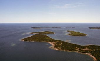
Manitoba’s principal resource is fresh water. Of Canada’s 10 provinces, Manitoba ranks third in water coverage. Lakes and rivers make up 101,590 km2 of the province, comprising one-sixth of its total area. The largest lakes are Winnipeg (24,387 km2), Winnipegosis (5,374 km2) and Manitoba (4,624 km 2). All three are the remnants of Lake Agassiz. In addition, many of Western Canada’s major rivers flow into southern Manitoba, namely the Saskatchewan, Red, Assiniboine and Winnipeg rivers.
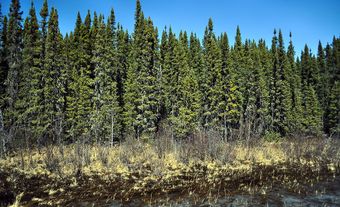
In terms of vegetation, southern Manitoba is characterized by open grassland. This grassland transitions to mixed forest toward the centre of the province. Further north is boreal forest and bush-tundra by Hudson Bay. (See also Geography of Manitoba.)
History
Indigenous People
(courtesy Native Land Digital / Native-Land.ca)
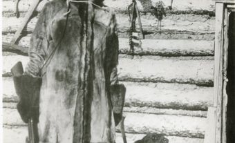
The area that became Manitoba is part of the traditional territory of the Assiniboine and Dakota who lived on the plains in the south, the Cree whose vast territory stretched from the plains to the Hudson Bay Lowland in the north, and the Dene who occupied the far north. The ancestors of these groups arrived in Manitoba between 10,000 and 13,000 BCE. The Anishinaabeg (see Ojibwa), today one of the largest Indigenous groups in Manitoba alongside the Cree, are much more recent arrivals, having lived in Manitoba for less than 300 years.
Prior to the arrival of Europeans, Indigenous people in Manitoba relied on hunting moose, caribou, bear and beaver, and to a lesser degree fishing. Those who lived in the Hudson Bay Lowland also hunted waterfowl such as geese, while the Indigenous people of the plains relied on buffalo as a source of food and material for clothing, shelter and tools. Items made of copper, pipestone, obsidian and shells found at archaeological sites in Manitoba indicate that prior to European contact, Indigenous people participated in long-distance trade networks that stretched as far as the Pacific Coast in the West and the Gulf of Mexico in the South.
Exploration: 1600s – 1700s
The history of European exploration in Manitoba did not begin in the south, but in the coldest and most remote area — the shores of Hudson Bay. In the early 1600s, a succession of navigators, including Thomas Button(1612), Jens Munk (1619–20), and Luke Fox and Thomas James (1631), searched the shoreline for the Northwest Passage.
The westward expansion of the fur trade encouraged further exploration in Manitoba. In 1670, two French Canadian explorers interested in the fur trade, Des Groseilliers and Radisson, persuaded Charles II of England to establish the Hudson's Bay Company and to grant it a huge territory (part of which is modern Manitoba), to be called Rupert’s Land.
Trading posts were soon established along the shores of Hudson Bay: Fort Hayes in 1682 (replaced with Fort York in 1684); and Fort Churchill in 1717–18 (replaced with Prince of Wales Fort in 1731). In 1690–92, Henry Kelsey, an HBC employee, penetrated southwest across the prairies to the Saskatchewan River. The La Vérendrye family then travelled west via the Great Lakes, building Fort Maurepas on the Red River (1734), followed by four other posts within the present area of Manitoba. The subsequent invasion of lands granted to the HBC by independent traders stimulated an intense rivalry for pelts, which ended only with amalgamation of the HBC and the North West Company in 1821. Although about 20 forts existed at various times south of latitude 54° N, the early explorers left few permanent impressions on the landscape.
The arrival of the fur trade, however, had a lasting impact on Indigenous people in Manitoba. Participation in the trade altered their traditional social and economic patterns as well as their territorial distribution. The ability to trade furs meant hunters now killed a surplus of animals rather than simply hunting enough for their own needs. With the introduction of European-made goods, Indigenous people abandoned their traditional tools and clothing, and became reliant on the fur trade to provide the necessities of life. The Cree and the Anishinaabeg, whose traditional territory had been the north shores of Lakes Huron and Superior, both expanded their territories westward in search of fur-bearing animals in order to retain their position in the trade. The increased interaction between these two neighbouring groups resulted in the creation of a hybrid Oji-Cree language and culture.
Interaction with European traders produced another more well-known culture: the Métis. Although intermarriage between explorers and fur traders and Indigenous women had occurred from the first arrival of Europeans in North America, in the early 19th century, the Red River Métis formed a distinctive culture which was a blend of Indigenous, French, English and Scottish influences. The Métis were renowned buffalo hunters and established a role for themselves as intermediaries in the fur trade, supplying North West Company traders with pemmican.
The arrival of Europeans also introduced diseases such as smallpox that devastated Indigenous populations. An outbreak of smallpox in 1781 is estimated to have killed nine-tenths of the Indigenous population around Churchill.
European Settlement: 1800s
Between 1682 and 1812, European settlement in Manitoba consisted of fur-trading posts established by the Hudson’s Bay Company, the North West Company and numerous independent traders. Agricultural settlement began in 1812 when the HBC granted Lord Selkirk a large tract of land at the junction of the Red and Assiniboine rivers to establish a colony for displaced Scottish and Irish tenant farmers. Over the next 45 years, the Red River Colony at Assiniboia survived hail, frost, floods, grasshoppers and skirmishes with the Nor'Westers and Métis over attempts by the colonists to restrict the sale of pemmican and the hunting of buffalo.
Further settlement was discouraged by the HBC monopoly as well as by the prevailing belief that the region was unsuited for agriculture. In 1857, the British government sponsored an expedition to assess the potential of Rupert's Land for agricultural settlement. That same year, the Canadian government, spurred by an expansionist movement in Upper Canada, sent Henry Youle Hind to do a similar assessment. The reports of these two expeditions encouraged settlement in the northwest, describing a fertile crescent of land suitable for agriculture extending northwest from the Red River Valley.
Red River Rebellion: 1869–70
In the 1860s, the Canadian and British governments wanted to expand westward, and began negotiating with the Hudson's Bay Company for the transfer of Rupert’s Land to the Dominion government. The negotiations were conducted with no concern for the actual inhabitants of the land, many of whom were Métis and First Nations. The Métis, angered that their rights were being ignored, organized to resist the acquisition of their lands. In 1869, under the leadership of Louis Riel, they seized control of Upper Fort Garry from the HBC and declared a provisional government (see Red River Rebellion). After a protracted standoff the Canadian government relented. The Manitoba Act of 1870, which transferred the lands of the northwest to the Dominion of Canada and created the new province of Manitoba, guaranteed Métis title to their lands along the Red and Assiniboine rivers and another 1.4 million acres for their descendants. Despite this apparent victory, Riel and the leaders of the rebellion were forced to flee as fugitives to the United States. In 1885, Riel was executed for high treason. The Canadian government failed to uphold the promises made to the Métis, while the settlers arriving in droves from Ontario discriminated against them. Many disaffected Métis moved west to continue practising their way of life, setting the stage for future conflict ( see North-West Rebellion).
Numbered Treaties: 1871–1907
(courtesy Native Land Digital / Native-Land.ca)
In 1871, the Canadian government also began negotiating with the Indigenous people in the Northwest with the aim of extinguishing Aboriginal title to the land to facilitate orderly westward expansion, free from the violence that beset the American West. The resulting series of treaties are collectively known as the “Numbered Treaties.” Manitoba is comprised of parts of Treaties 1, 2, 3, 4, 5, 6 and 10 which were signed between 1871 and 1907. Much like with the Métis, the Canadian government has failed to uphold the promises and assurances made during the negotiation and signing of these treaties.
Expansion: Late 1800s – Early 1900s
In 1870, Manitoba was slightly larger than the Red River Valley; the remainder of what is now Manitoba was still the Northwest Territories at the time, administered directly by the Dominion government. Settlement of the new province followed the Dominion Lands Survey and the projected route of the national railway. The lands of the original province of Manitoba were granted to settlers in quarter-section parcels for homesteading purposes under the Dominion Lands Act of 1872. (See also Manitoba and Confederation.)
It was soon evident that the diminutive province needed to expand. Settlers were rapidly moving to the northwest and spilling over the established boundaries. Between 1876 and 1881, 40,000 immigrants, mainly British Ontarians, were drawn west by the prospect of profitable wheat farming enhanced by new machinery and milling processes. Mennonites and Icelandic immigrants also arrived in the 1870s, the former settling around Steinbach and Winkler, the latter near Gimli and Hecla. Immigration then slowed until the late 1890s and was mostly limited to small groups of Europeans.
In 1881, after years of political wrangling with the federal government, the boundaries were extended to their present western position, as well as being extended farther east, and to 53° N lat. It was not until 1912, however, that the current boundaries of the province were set.

Between 1897 and 1910, there was great prosperity and development, and settlers from Eastern Canada, Britain, the United States and Eastern Europe, especially Ukraine, inundated the province and the neighbouring lands. The latter group, previously considered undesirable, were now actively encouraged to immigrate by Minister of the Interior and MP from Brandon, Clifford Sifton. Sifton believed that Eastern European peasants were better suited to settling and farming in the often harsh conditions of Canada’s West than the traditionally preferred immigrants from Britain.
Development: Early 1900s – Second World War

From 1897 to 1910, Manitoba enjoyed unprecedented prosperity. Transportation rates fell and wheat prices rose. Grain farming still predominated, but mixed farms prospered and breeders of quality livestock and plants became famous.
Winnipeg swiftly rose to metropolitan stature, accounting for 50 per cent of the increase in the province’s population. The city developed a vigorous business centre, radiating from the corner of Portage Avenue and Main Street. Department stores, real estate and insurance companies, legal firms and banks thrived. Abattoirs and flour mills directly serviced the agricultural economy while service industries, railway shops, foundries and food industries also expanded.
Both the Canadian Pacific Railway and the Canadian Northern Railway (later the Canadian National Railway) built marshalling yards in the city, which became the hub of a vast network of rail lines spreading east, west, north and south. In 1906, hydroelectricity was first generated at Pinawa on the Winnipeg River, and the establishment of Winnipeg Hydro on 28 June 1906 guaranteed the availability of cheap power for domestic and industrial use.
The general prosperity ended with the depression of 1913; freight rates rose, land and wheat prices plummeted and the supply of foreign capital dried up. The opening of the Panama Canal in 1914 ended Winnipeg's transportation supremacy, since goods could move more cheaply between east and west by sea than overland.

During the First World War, recruitment, war industry demands and the cessation of immigration sent wages and prices soaring. By 1918 inflation seemed unchecked and unemployment was prevalent. Real wages dropped, working conditions deteriorated and new radical movements grew among farmers and urban workers, culminating in the Winnipeg General Strike of May 1919. The discontent of the farmers found expression in the Progressive Party, which garnered 65 seats (12 from Manitoba) in the federal election of 1921 and won Manitoba’s provincial election in 1922.
The First World War was a particularly difficult period for the Eastern European immigrants who had come to Manitoba in the previous two decades, particularly the Ukrainians whose homeland was part of the Austro-Hungarian Empire with which Canada was at war. Several were interned as enemy aliens while those who were not faced discrimination.
In the midst of the First World War, on 28 January 1916, Manitoba became the first province to grant women the right to vote and hold political office provincially (see Women’s Suffrage). Prominent members of Manitoba’s suffrage movement included Margret Benedictsson, Nellie McClung, Ella Cora Hind, Francis Marion Beynon, Lillian Beynon Thomas and Amelia Yeomans (see also Timeline: Women’s Suffrage in the West).
An industrial boom followed postwar depression in the late 1920s. By 1928, the value of industrial production exceeded that of agricultural production. Agricultural depression continued and deepened in the 1930s, aggravated by drought, pests and low world wheat prices. As a result the movement of the province’s population from farm to city and town accelerated. During the 1930s, however, industry flagged and unemployment was high in urban centres.
To eliminate the traditional boom/bust pattern, attempts were made to diversify the economy, as exemplified by the expansion of the mining industry. The demands of the Second World War reinforced Manitoba's dependency on agriculture and primary production, but the postwar boom gave the province the opportunity to capitalize on its established industries and to broaden its economic base.
Demographics
Population
Since 1961, Manitoba's population growth has been slow but steady, rising from 921,686 in 1961 to 1,342,153 in 2021. Manitoba's population is disproportionately distributed between the "North" and the "South." Although the northern region, the border of which runs from the southern shore of Lake Winnipegosis in the west to the southern shore of Lake Winnipeg in the east, comprises 79 per cent of the province’s area, it is home to a small percentage of the province’s population. Settlement of the north is confined to isolated fishing stations and mining towns, scattered First Nation reserves and Churchill, a far-north trans-shipment centre on the shores of Hudson Bay.
Language and Ethnicity
The majority of Manitoba’s population (70.5 per cent) identifies English as their mother tongue, according to the 2021 Census. Other prevalent languages are German, Tagalog, French, Punjabi, Hindi, and Spanish.
According to the 2021 Census, about 73.8 per cent of Manitoba’s population is of European ethnic origin. Among this group, those who claim British Isle ancestry are the largest, followed by German, Ukrainian and French. Since the establishment of the New Iceland settlement on the western shore of Lake Winnipeg in 1875, Manitoba has also had a relatively large population with Icelandic origins (2.5 per cent). Those of Indigenous origin, including First Nations, Métis and a small number of Inuit, comprise roughly 18 per cent of the population. The province is also home to a large number of persons of Filipino and South Asian origins (7.2 per cent and 5.4 per cent respectively), concentrated primarily in Winnipeg.
Religion
Manitoba’s population is predominantly Christian, though more than 36 per cemt of the population identifies as having no religious affiliation. The largest Christian denomination is the Roman Catholic Church, followed by the United Church and the Anglican Church. Historically, the province also has small but significant numbers of people belonging to the Mennonite, Ukrainian Catholic and Ukrainian Orthodox churches. Those belonging to non-Christian denominations comprise roughly 8 per cent of the province’s population.
Towns, Cities and Reserves
List of Manitoba’s 10 Largest Cities
| Name | Population |
| Winnipeg | 749,607 |
| Brandon | 51,313 |
| Steinbach | 17,806 |
| Winkler | 13,745 |
| Portage la Prairie | 13,270 |
| Thompson | 13,035 |
| Selkirk | 10,504 |
| Morden | 9,929 |
| Dauphin | 8,368 |
| The Pas | 5,639 |
Source: Statistics Canada, 2021 Census
When Manitoba joined Confederation, only 4 per cent of its population lived in urban centres. Although it became progressively more urbanized, the province’s population continued to be predominantly rural until 1951. As of the 2016 Census, 73 per cent of Manitoba’s population is urban.
Winnipeg, the provincial capital, is Manitoba’s largest city. Metropolitan Winnipeg accounts for about 62 per cent of the province’s population.
Following the decision to have the Canadian Pacific Railway cross the Red River at Winnipeg (1881), the city became the economic and transportation hub of Western Canada, dubbed the “Chicago of the North” during the boom years at the turn of the 20th century. Since the Second World War, Winnipeg has experienced modest growth. It is the provincial centre of the arts, education, commerce, finance, transportation and government.
Although Winnipeg's pre-eminence within the province is unchallenged, certain urban centres dominate local trading areas. Brandon, Manitoba's second-largest city, is a distribution and manufacturing centre for the southwest, as is the smaller Portage la Prairie, set in the Portage plains, one of the richest agricultural tracts in the province. In the north, Thompson and Flin Flon service the mining industry.
The cities of Selkirk and Dauphin, and the town of The Pas, were founded as fur-trading forts and today serve as distribution centres for their surrounding communities. Bissett is a small northern mining centre.
There are also 376 reserves in Manitoba, held by 63 First Nations. In addition, Animakee Wa Zhing, a First Nation based in Ontario, has a reserve that straddles the Ontario-Manitoba border. As of 2019, there were 162,787 registered Indians in Manitoba, 58 per cent of whom lived on-reserve. (See also Reserves in Manitoba.)
Economy
Hunting and trapping constitute Manitoba's oldest industry; however, today it is one of the province’s smallest. For 200 years, the Hudson’s Bay Company dominated trade in furs across Western Canada as far as the Rocky Mountains. Alongside the fur trade, buffalo hunting developed into the first commercial return of the plains. First Nations people, Métis and voyageurs traded meat, hides and pemmican, which became the staple food of the region.
Until 1875 the fur trade was the main business of Winnipeg, which was by then an incorporated city of 5,000 and the centre of western commerce. In the city, the retail and real estate business grew in response to a new pattern of settlement and the development of agriculture. Red Fife wheat then became the export staple that replaced the beaver pelt.
After the westward extension of the main Canadian Pacific Railway line in the 1880s, farmers and grain traders could expand into world markets and an east-west flow of trade began, with Winnipeg acting as the "gateway" city. In the decades that followed, agriculture diversified to include a wider variety of crops, and in time, the economy as a whole has diversified to include such prominent industries as mining, forestry and manufacturing.
Agriculture

Agriculture plays a prominent role in the provincial economy; however, its contribution to the province’s GDP can vary substantially year-to-year because of factors such as crop production and prices, which are generally beyond the control of farmers.
The variety of crops grown in Manitoba has increased significantly since the start of the 20th century, when the only recorded crops in the province were wheat, oats and barley, as well as flaxseed, rye, dry peas and potatoes. Today, the province also grows small amounts of fruit, mushrooms and lentils; however, they do not make a significant contribution to the overall agricultural production. Despite Manitoba’s cool and arid conditions, crop yields have doubled since the 1960s. Since the 1970s, when canola was developed by researchers at the University of Manitoba, oilseed crops such as canola, sunflowers and soybeans have become more prominent. Today, canola, wheat, soybeans and potatoes are some of the province’s most valuable crops. Pigs are Manitoba’s most important livestock and the province is one of the largest pig-producing and -exporting regions in the country. Manitoba is also one of the country’s largest cattle producers. The province also has smaller numbers of dairy, poultry and sheep farms.
Agriculture is never likely to expand beyond the limits imposed by the shortness of the growing season (less than 90 days frost-free) and the poor podsolic soils associated with the Canadian Shield. Periodic flooding of the upper Red River (south of Winnipeg) poses challenges to farmers, often damaging farm infrastructure and crops. In recent decades in Manitoba, as well as in the rest of Canada, there has been a trend towards fewer but larger farms.
Mining
Manitoba ranks fourth among the provinces in terms of crude oil production. Oil deposits in Manitoba are located in the southwest corner of the province as well as in the Hudson Bay Lowland. In the first decade of the 21st century, oil production grew rapidly in Manitoba, increasing by just over 200 per cent, from 621,378 m3 in 2000 to 1,873,445 m3 in 2010. This growth has been spurred by the availability of hydraulic fracturing technology.
The primary metals mined in Manitoba are zinc, cobalt, nickel, copper, gold and silver. In 2014, Manitoba produced about 24 per cent of Canada’s zinc, 12 per cent of Canada’s nickel and 100 per cent of Canada’s cesium, a necessary ingredient in the production of electronics, batteries and jet engines.

All metals in Manitoba are found in the vast expanse of Canadian Shield. Manitoba's most productive metal mines are at Thompson, which accounts for all of Manitoba's nickel production. The province's oldest mining area, dating from 1930, is at Flin Flon. Along with its satellite property at Snow Lake, it is a major producer of copper and zinc, and small amounts of gold and silver. Ongoing developments are expected to extend mining operations in the Flin Flon–Snow Lake region to 2030, a full century since mining in the region first began.
Energy
Manitoba Hydro, a crown corporation, is the sole authority for the generation, development and distribution of electric power in Manitoba as well as the largest distributor of natural gas in the province. The vast majority of the electricity produced by Manitoba Hydro comes from 15 hydroelectric generating stations on the Nelson, Winnipeg, Saskatchewan, Burntwood and Laurie rivers. The remainder comes from two thermal generating stations fueled by coal and natural gas, four diesel generating stations and purchases from independent wind power farms within the province.
The generation and distribution of power in Manitoba was initially conducted by several small companies and municipal utilities. By the time of the Second World War, these smaller entities had mostly amalgamated into three utilities: the Winnipeg Electric Company, City of Winnipeg Hydro Electric System and the Manitoba Power Commission. Desiring further consolidation, in 1949 the Government of Manitoba created the Manitoba Hydro-Electric Board, which purchased the Winnipeg Electric Company in 1952. In 1961, the government amalgamated the Manitoba Hydro-Electric Board and the Manitoba Power Commission forming Manitoba Hydro. In 2002, Manitoba Hydro purchased Winnipeg Hydro from the city of Winnipeg consolidating all of the generation and distribution of power in the province under a single entity.
Roughly one-third of Manitoba Hydro’s revenue comes from the export of surplus electricity. The majority of Manitoba Hydro’s electricity exports are to the United States where the peak period of electricity consumption (summer) corresponds with Manitoba’s lowest period of consumption. The revenue generated from extra-provincial sales of surplus electricity allows Manitobans to enjoy some of the lowest electricity rates in North America.
Forestry
Forestry is Manitoba’s fifth largest manufacturing sector. The most productive forestlands extend north of the agricultural zone.
In order of decreasing volume, the most common commercial tree species are black spruce, jack pine, trembling aspen, white spruce, balsam poplar and white birch. Other species common to Manitoba include balsam fir, larch, cedar, bur oak, white elm, green ash, Manitoba maple, and red and white pine.
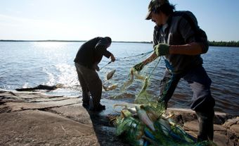
Fisheries

The commercial inland fishery has been active in Manitoba for over 100 years. Water covers nearly 16 per cent of Manitoba, of which an estimated 57,000 km2 is commercially fished. Lake Winnipeg, the province’s largest commercial fishery, and Lake Manitoba account for the majority of production. Commercial catch is delivered to lakeside receiving stations located throughout the province and is then transported to the Freshwater Fish Marketing Corporation's central processing plant in Winnipeg. All the commercial catch is processed at this plant.
Thirteen commercial species include whitefish, pike, walleye and sauger. Sauger, pike, walleye, trout and catfish are principal sport fish. The Manitoba Department of Natural Resources maintains hatcheries for pickerel, whitefish and trout.
Manufacturing
Manufacturing is the largest sector in Manitoba's economy, accounting for over 10 per cent of the province’s GDP as of 2016. Manufactured goods in Manitoba are generally for export, either to other provinces or to other countries. The country’s largest furniture plants are located in Manitoba, and the province leads North America in the production of intercity and urban buses. Other manufacturing industries include food processing (namely meat processing) as well as grain and oilseed milling, and machinery manufacturing.
Labour Force
In recent years, Manitoba has boasted one of the lowest unemployment rates in the country. In 2021, for example, the province’s unemployment rate was 8.3 per cent, the third lowest in the country. By industry, the largest number of Manitobans are employed in healthcare and social assistance, followed by retail trade, manufacturing and educational services.
Provincial Government

There are 57 seats in Manitoba’s provincial government. Each seat is held by a member of the Legislative Assembly (MLA) elected by eligible voters in their electoral district. The boundaries of the province’s 57 electoral districts are set to include between 250 and 400 voters. General provincial elections are held every four years on the first Tuesday in October. Sometimes, should the party in power see it as advantageous, an election may be called before this date. When the party in power holds a minority of seats, elections may also occur before four years have passed in the case where the party in power holds a minority of seats and the government no longer has the confidence of the Assembly.
As with the other provinces, Manitoba uses a first-past-the-post electoral system, meaning the candidate with the most votes in each electoral district wins. Typically, the party with the most seats forms the government, and the leader of this party becomes premier. However, a party with fewer seats may also form a coalition with members of another party or parties in order to form the government.
Technically, as the King’s representative, the lieutenant-governor holds the highest provincial office, though in reality this role is largely symbolic. (See also Manitoba Premiers: Table; Manitoba Lieutenant-Governors: Table.)
The premier typically appoints members of the Cabinet from among the MLAs also belonging to the party in power. Cabinet members are referred to as ministers and oversee specific portfolios. Typical portfolios include finance, health and education. (See also Politics in Manitoba.)
Health Care
Most medical services in Canada are free. Money from taxes is pooled together to fund a health care system often referred to as Medicare. While the federal government sets guidelines, each province and territory is responsible for administering its own health care insurance plan; funding for the plan comes from both governments. As with other provinces and territories, certain services in Manitoba are not covered by the provincial health insurance plan. These include going to the dentist, prescription drugs, and routine eye exams for those between the ages of 19 and 65.
In Manitoba, the government department responsible for administering the health care system is Manitoba Health, Seniors and Active Living. (See also Health Policy.)
Education
Francophones’ battle for the right to receive education in their own language has coloured the history of education in Manitoba. The fight began shortly after the establishment of Manitoba as a province and led to a series of events now known as the Manitoba Schools Question.
In 1870, the Manitoba Act created the province of Manitoba, and also established separate Catholic and Protestant school systems; Catholics would receive instruction in French, Protestants in English. However, in 1890, the provincial government (under the leadership of Thomas Greenway) stopped funding Catholic and Protestant schools, creating a single, English-language public school system. If Catholics, most of whom were francophone, wanted to receive instruction in both their religion and language they would have to fund the schools themselves.
In 1896, Prime Minister Wilfred Laurier’s federal government intervened, negotiating a compromise with the province. Some religious education would be provided in the public school system, and in certain situations, instruction in languages other than English.
This compromise was repealed in 1916 by Premier Tobias Crawford Norris’ provincial government. Teaching of any language other than English, or using another language to instruct a class, became prohibited.
After a hiatus of over 30 years, French began to be reinstated in the public school system in 1947. At this time, French could be taught as a foreign language in secondary schools. In 1955, French began to be taught in grades 4 through 6. A series of additional provisions followed until Manitoba’s first French-immersion school — École Sacré-Cœur — was finally established in Winnipeg in 1973. In 1993, the government created a separate francophone school division. Today, Manitobans with French as a second language may attend French-immersion schools, and those with French as their mother tongue may attend schools in the “Français” program.
Colleges and Universities
Assiniboine Community College operates in and outside Brandon and is responsible for all community college agricultural training in the province. Keewatin College offers certificate courses of one year or less, and diploma courses, mostly in northern Manitoba. Red River College, located in Winnipeg, provides courses including applied arts, business administration, health services, industrial arts and technology.
In 1877, St. Boniface (French, Roman Catholic), St. John's (Anglican) and Manitoba (Presbyterian) colleges united as the University of Manitoba. Later, other colleges joined them, but in 1967 a realignment resulted in three distinct universities: the University of Manitoba, the University of Winnipeg and Brandon University. The University of Manitoba is one of the largest universities in Canada, with four affiliated colleges that provide instruction in French: St. John's and St. Paul's (Roman Catholic); St. Andrew's (Ukrainian Orthodox); and St. Boniface, which is the only college providing instruction entirely in French. Manitoba is also home to the Canadian Mennonite University, which opened its doors in 1999 following the amalgamation of several Mennonite colleges.
Transportation

Winnipeg is located in the heart of Canada and has historically been a vital link in all forms of east–west transportation.
The York Boats of the fur trade and the Red River carts of early settlers gave way first to steamboats on the Red River, then to the great railways of the 19th and early 20th centuries. Subsequently, Winnipeg provided facilities for servicing all land and air carriers connecting east and west. Today, rail and road join Winnipeg with the principal mining centres of northern Manitoba. During the long, cold winter, a complex system of interconnected lakes creates a network of winter roads. Major northern centres are linked to the south via major highways.
Since 1926, bush flying has made remote communities accessible; several small carriers serve the majority of northern communities. In 1928, the Stevenson Aerodrome opened an airfield in St. James. By 1950, Stevenson Field was the fourth largest civil airport handling more military traffic than any other airport in Canada. Upgrades were also made beginning in the 1950s to transform the facility into a modern passenger-oriented terminal. Stevenson Field was renamed Winnipeg International Airport (YWG) in 1958. In 1997, ownership of the airport was transferred from Transport Canada to the Winnipeg Airports Authority Inc. In 2006, the facility, Canada’s longest-serving international airport, was renamed once again after aviation pioneer James Armstrong Richardson.
As Canada's principal midcontinent rail centre, both the Canadian National Railway and Canadian Pacific Railway have extensive maintenance facilities and marshalling yards in and around Winnipeg. The CNR owns Symington Yards, one of the largest and most modern marshalling yards in the world. At Transcona, it maintains repair and servicing shops for rolling stock and locomotives, and Gimli has a national employee-training centre. In addition to repair shops and marshalling yards, the CPR has a large piggyback terminal.
In 1929, the Hudson Bay Railway, now part of the CNR system, was completed to the port of Churchill. Formerly an army base, Churchill is also a research centre and a supply base for eastern Arctic communities.
Arts and Culture
The Manitoba Arts Council promotes the study, enjoyment, production and performance of works in the arts. It assists organizations involved in cultural development; offers grants, scholarships and loans to Manitobans for study and research; and makes awards to individuals. The Winnipeg Symphony Orchestra, Royal Winnipeg Ballet, Royal Manitoba Theatre Centre, Le Cercle Molière, Manitoba Opera Association, School of Contemporary Dancers and Rainbow Stage all contribute to Winnipeg's position as a national centre of the performing arts.
Many famous Canadian musicians and musical groups hail from Manitoba, including bands The Guess Who, Bachman-Turner Overdrive, Crash Test Dummies, Harlequin, Streetheart, the Watchmen and the Weakerthans. Notable Manitoba musicians include Randy Bachman, Burton Cummings, Chantal Kreviazuk, jazz musicians Marilyn Lerner and Ron Paley, and children’s singer Fred Penner.
Among well-known and respected Manitoban writers are novelists Margaret Laurence, Gabrielle Roy, Miriam Toews, Sandra Birdsell, Adele Wiseman and Guy Gavriel Kay. In addition, essayist, historian and poet George Woodcock, and popular historian Barry Broadfoot are also from Manitoba. The Winnipeg Art Gallery, in addition to traditional and contemporary works, houses the largest collection of contemporary Inuit art in the world.
Sports
Manitoba is home to one National Hockey League team, the Winnipeg Jets, and one Canadian Football League team, the Winnipeg Blue Bombers. The Jets play out of the MTS Centre and the Blue Bombers out of the Investors Group Field stadium. The Manitoba Moose are the Jets’ American Hockey League affiliate team. The Winnipeg Goldeyes are the only Canadian members of the American Association of Independent Professional Baseball, and play out of Shaw Park, just north of The Forks.
Museums and Historic Sites

Manitoba's historic past is preserved by the Manitoba Museum (Winnipeg), considered one of the finest interpretive museums in Canada; by the Living Prairie Museum, a 12-hectare (ha) natural reserve that preserves prairie plants and wildlife; by Le Musée de St. Boniface, rich in artifacts from the Red River colony; and by the Provincial Archives and Hudson's Bay Company Archives, all located in Winnipeg. In 2014, the Canadian Museum for Human Rights (CMHR) opened its doors to visitors as the world’s first museum dedicated to the study and celebration of human rights.

The Hudson’s Bay Company's Lower Fort Garry is a hallmark historic site that showcases the settlement of the West. Built in 1832 and situated on the Red River 32 km northeast of Winnipeg, it is the oldest intact stone fort in Western Canada, preserving much of the atmosphere of the Red River Colony. The Forks, a waterfront redevelopment and national historic site, is the birthplace of Winnipeg. Located at the junction of the Red and Assiniboine rivers, this site was an early Indigenous settlement and has been used as a trade and meeting place for over 6,000 years. Today, it is again a place where recreational, cultural, commercial and historical activities bring people together. Upper Fort Garry Gate, the only remnant of another HBC fort, is nearby.
Among a number of historic houses is Riel House, home of the Riel family. York Factory, located at the mouth of the Nelson River and dating from 1682, was a transhipment point for furs. The partially restored Prince of Wales Fort (1731–82) at the mouth of the Churchill River was built by the HBC and destroyed by the French. Other points of historical significance are St. Boniface Basilica, the oldest cathedral in Western Canada and the site of Louis Riel’s grave; Macdonald House, home of Sir H. J. Macdonald; Fort Douglas; Ross House; and Seven Oaks House.