Share on Facebook
 Share on X
 Share by Email
 Share on Google Classroom
History
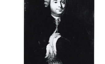
The name is a throwback to the seigneury of Châteauguay granted to Charles Le Moyne in 1673. The seigneury was first known as “chasteau de Guay,” a combination of Le Moyne’s fortified manor or chasteau (château), and the name Gué or Guay, of the caretaker. It eventually became today’s Châteauguay.
The chateau sat on Île de Saint-Bernard, at the mouth of the river. The island is still topped by a beautiful and elegant masonry tower dating back to the late 1680s. It is a remnant of one of the oldest windmills in North America, which was originally used as a control post and fortification to oversee the entrance to Lac Saint-Louis.
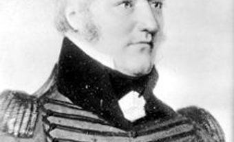
During the War of 1812, Châteauguay was an outpost for the British army. One of Canada’s most significant battlegrounds, the site of the Battle of Châteauguay, is 30 km upstream from the city. In October 1813, Lieutenant-Colonel Charles-Michel de Salaberry, who was stationed in Châteauguay, rushed to this spot where he and his men defeated a larger American invasion contingent led by General Wade Hampton. The battleground is now a national historic site.
Present Day
This largely French-speaking community (53 per cent of residents reported French as their mother tongue during the 2021 census) is a well-organized residential suburb of Montreal. It has a large industrial park, and its city hall is a restored, mid-19th-century Roman Catholic convent. The Sisters of the Congrégation de Notre-Dame founded and administered the convent. Also of interest is the historic Saint-Joachim Roman Catholic church, dating back to 1775.