Share on Facebook
 Share on X
 Share by Email
 Share on Google Classroom

Description
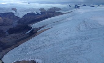
In permafrost regions, the upper layer that undergoes seasonal freezing and thawing is called the active layer. Below this lies the permafrost, the upper surface of which is called the permafrost table. Permafrost is mapped according to three different categories: continuous (where more than 80 per cent of the ground is permafrost), discontinuous (between 30 and 80 per cent) and sporadic (less than 30 per cent). Permafrost may extend up to 1,500 m into the ground in cold Arctic regions, compared to a few metres in warmer areas.
Development
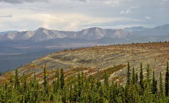
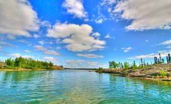
Permafrost is found in areas at high latitude and altitude with long, cold winters and thin winter snow cover (as snow acts as an insulator for the ground from winter cold). Cold-air drainage in mountain valleys or through rock caves may cause pockets of permafrost in the sporadic zone.
The permafrost in Canada developed largely after the last glaciation, and its distribution has varied over time due to changes in climate. For example, in the mid-19th century, the continuous permafrost zone extended to south of Tulita, Northwest Territories. However, 4°C warming of the winter air temperature resulted in the migration of its southern boundary to nearly Inuvik, Northwest Territories. Since 1940, a 2°C cooling in the mean winter temperature has resulted in the boundary moving southwards again to Tsiigehtchic. Now the southern limit of permafrost is moving north once more in response to climatic warming, especially along the Mackenzie Valley. Similar changes can be demonstrated in other areas, such as alpine regions, Alaska and northern Russia.
Regions

Permafrost underlies 40–50 per cent of Canada. The greatest thicknesses in Canada are over 1,000 m at high elevations in parts of Baffin and Ellesmere islands, ranging down to 60–90 m at the southern limit of the continuous permafrost zone. The thickness of active layer permafrost ranges from under 10 cm on Ellesmere in porous sediments to 15 m at high altitudes in the fissured, impermeable rocks in the mountains of southwestern Alberta on the outer margin of continuous permafrost. The coldest ground temperatures in permafrost in Canada are found on Ellesmere Island (about -15°C).
Landforms


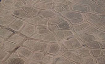
Distinctive landforms are associated with permafrost (see Periglacial Landform). These landforms include ice wedges, polygonal ground and pingos. Ice wedges result from the ground cracking in winter, followed by the cracks being filled with snow and meltwater during spring and summer. The resulting wedges of ice create interconnected, polygonal shapes on the Earth’s surface called polygonal ground. Pingos are ice-cored mounds up to 100 m high. They are formed when water in the ground changes to ice and expands so that the resulting ice masses force the overlying ground upwards.
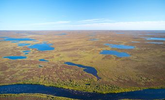
Thawing of permafrost often results in the ground sinking where ice was present, and in the formation of thaw lakes or mounds (hummocks). This terrain, called thermokarst, can be induced by human activities or by climate change.
Human Activity
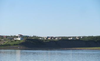
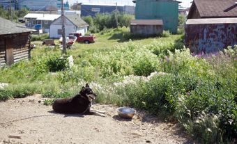
Permafrost poses significant challenges to modern human settlement and industrial activity. For example, permafrost makes agriculture difficult, contributing to the higher cost of food in northern Canada. Heated homes and buildings are generally built on top of piles with enough air space underneath to avoid thawing the permafrost. Similarly, paved roads or runways require an insulating layer so as not to warm the ground and subsequently melt the permafrost.
Because the ground is frozen, garbage and sewage disposal is also difficult in areas with permafrost, as is the grounding of electrical devices. As much garbage is incinerated as possible, while electrical cables are usually placed above ground to avoid being severed by the earth cracking in winter. Water and sewage pipes must be insulated or placed in insulated boxes on piles called utilidors.
The permafrost areas of the northern hemisphere are underlain by significant reserves of oil, gas, diamonds and metal ores. However, permafrost poses a challenge to extracting these resources. Once extracted, there are also challenges in getting these commodities to market.
Climate Change
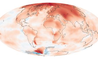
Soil temperatures in many areas are rising as a result of climate change. As temperatures rise, the permafrost layer melts and thins, and in some cases may disappear completely. When permafrost melts, methane and carbon dioxide stored in the soil are released into the atmosphere. Because methane and carbon dioxide are greenhouse gases (gases that trap heat in the Earth’s atmosphere), melting permafrost helps perpetuate climate warming — the process that caused it in the first place.