Share on Facebook
 Share on X
 Share by Email
 Share on Google Classroom
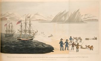
Amund Ringnes Island, 5255 km2, located between Ellef Ringnes and Axel Heiberg islands in the Arctic Archipelago. It is flat (highest point about 610 m) and windswept; in winter its coasts are virtually indistinguishable from the surrounding ice.
Amund Ringnes Island, 5255 km2, located between Ellef Ringnes and Axel Heiberg islands in the Arctic Archipelago. It is flat (highest point about 610 m) and windswept; in winter its coasts are virtually indistinguishable from the surrounding ice. It was discovered 20 April 1900 by Gunerius Isachsen, a member of the Norwegian Sverdrup expedition, and named for a member of the brewery that financed the expedition. It was surveyed 1916 by V. Stefansson, who found coal and gypsum on the island.