Share on Facebook
 Share on X
 Share by Email
 Share on Google Classroom
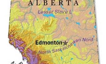
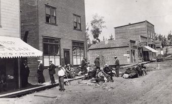
Fort Assiniboine, Alta, Unincorporated Place. Fort Assiniboine is located at the confluence of the Freeman and Athabasca rivers, 150 km northwest of Edmonton. There may have been earlier posts in the area, but the first documented FUR TRADE site was Fort Assiniboine, established in 1823-24. Fort Assiniboine became a transportation centre for goods carried by pack horse from FORT EDMONTON to Lesser Slave Lake post, Jasper House and Dunvegan after George Simpson had a trail cut from Fort Edmonton to Fort Assiniboine. This trail continued to be used up to the 1870s, and was revived in 1897-98 as part of the Chalmers Trail, cut to assist travellers trying to reach the Klondike gold fields through Canada. A few homesteaders arrived prior to WWI, and a ferry operated at Holmes Crossing as early as 1906-07. In 1956 a bridge was built across the Athabasca River and in 1959 a highway was completed into the Swan Hills area (now known as the Grizzly Trail).
The highway helped to open the Swan Hills area to oil and natural gas exploration and development. A number of saw and lumber mills have operated in the area since the early 20th century. Local residents also farm, and some have found employment in the tourism industry. Incorporated as a village in 1958, Fort Assiniboine gave up this status in 1991 and is now part of the Municipal District of Woodlands.