Share on Facebook
 Share on X
 Share by Email
 Share on Google Classroom


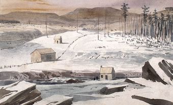
Demarcation of the Forty-ninth Parallel
The section from Lake of the Woods to the summit of the Rocky Mountains was agreed to in the Convention of 1818, and that from the Rockies to the Strait of Georgia in the Oregon Treaty of 1846. As ultimately surveyed and demarcated, the boundary actually consists of several chords drawn between astronomically determined points on the curved parallel.
The parallel also forms the first baseline for the Dominion Lands Survey System by which the territory that became the provinces of Manitoba, Saskatchewan and Alberta and some adjacent parts of British Columbia and Ontario was subdivided. It and the baselines every 24 miles (38.6 km) north of it are east-west survey control lines which are run as 6 mile (9.6 km) chords to curved parallels of latitude.