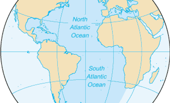
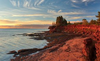
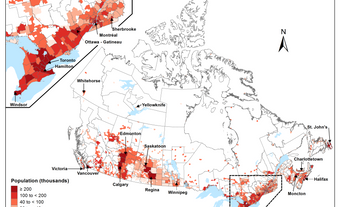
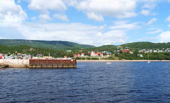
Nova Scotia is part of the Appalachian region, one of Canada seven physiographic regions. The province is primarily a peninsula extending from the country’s mainland. At its northeastern end is Cape Breton Island. Surrounded by the Atlantic Ocean, Nova Scotia is separated from Prince Edward Island by the Northumberland Strait and from New Brunswick by the Bay of Fundy.

Atlantic Upland
The Atlantic Upland is one of Nova Scotia’s chief physical features and is recognized by its five fragments, separated in places by extensive lowlands. Of these fragments, the largest is the Southern Upland, which occupies the southern and central part of the province. Starting at the rugged Atlantic coast, and marked by many inlets, islands, coves and bays, it rises to an altitude of 180 to 210 m in the interior. Its northern border constitutes the South Mountain. The second fragment is the North Mountain, a range of trap rock that runs parallel to the South Mountain for 190 km along the Bay of Fundy, from Cape Blomidon, on Minas Basin, to Brier Island.
Between the two mountain ranges lie the fertile valleys of the Annapolis and Cornwallis rivers, which together constitute the well-known apple-growing region of Nova Scotia. The third fragment consists of the flat-topped Cobequid Mountain, rising to 300 m and extending 120 km across Cumberland County, while the fourth has its beginnings in the eastern highlands of Pictou County. It extends in a long narrowing projection through Antigonish County to Cape George. The fifth fragment, on northern Cape Breton Island, is a wild, wooded plateau that peaks to a height of more than 550 m above sea level. It contributes to the scenic character of Cape Breton Highlands National Park, especially as viewed from the Cabot Trail, which runs through it. In contrast, the southern part of Cape Breton Island is largely lowland.
Geology
The deep drainage channels that cut through the uplands have exposed the roots of the mountains. The exposure has laid bare rocks that are among the oldest of the Earth’s crust and are representative of most of the geological time scale. Peninsular Nova Scotia consists of Paleozoic cover pierced by a granite backbone that, because it is highly resistant to change, occupies the higher elevations.
The North Mountain resulted from volcanic action in Triassic times, and the Annapolis and Cornwallis valleys were carved out in the same period. Practically all the industrial minerals, including gypsum, limestone, sandstone, salt and barites, occur in rocks of the Mississippian age. The coal deposits of the province are found in several groups of Pennsylvanian rocks, especially the Pictou, Stellarton and Morien groups.
Surface and Vegetation
Originally, most of the province was covered by forest, but little of the virgin forest remains, except in the plateau of northeast Cape Breton Island. Secondary growth has tended to be coniferous because of the acid soil and the slow growing season. However, hardwoods continue to exist in sufficient abundance to produce a colourful display in the autumn. In swampy areas and rocky barrens, mosses, lichens, ferns, scrub heath and similar growths are common. Wild flowers found in the province include the mayflower, pitcher plant, white water lily and several varieties of violets.
Widely found throughout the province are herbaceous plants such as Clintonia, cranberries, blueberries and many species of goldenrod. The European cuckooflower has become common in the Annapolis Lowland, while the ragwort has spread over eastern Nova Scotia.
Roughly 29 per cent of Nova Scotia’s land is suitable for agriculture. The best farming land is in the lowlands, where soils have developed on deep tills. By comparison, the uplands usually have shallow, stony soils. The most extensive lowlands, and hence the best agricultural land, are along the Bay of Fundy and Northumberland Strait. The high tides of the Bay of Fundy have created large areas of marshland. By means of dikes begun in Acadian times, this marshland has been converted into valuable agricultural lands.
Water
Nova Scotia includes over 3,000 lakes, as well as hundreds of streams and small rivers. Because of the general direction of the watersheds, the rivers are not long. However, with moderately heavy precipitation, normally no shortage of water occurs.
The province’s largest lake, the 1,099 km2 Bras D’Or, was created when the sea invaded the area between the upland and lowland areas of Cape Breton. Saline and tideless, it is widely used for recreation. On the peninsula, the largest lake is Lake Rossignol.
Though short, the rivers are both economically and historically significant. The Sackville and Shubenacadie, used extensively by Indigenous peoples, were important in early transportation. Some, such as the Mersey, continue to play a significant role in lumber and pulpwood production. Others, such as the Margaree and St. Mary’s, have become celebrated as salmon streams. Several rivers have afforded the means to construct hydroelectric power plants, however small.
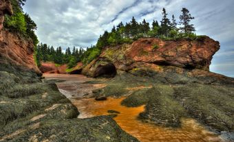
The high tides of the Bay of Fundy are a remarkable phenomenon. The bay divides into Minas Basin and Chignecto Bay on the province’s northwest coast. At high tide, the water is forced forward to reach a height over 16 m above low-tide level in its narrowest extremities. The high tides facilitate the loading of gypsum, lumber and the like by freighters, which at low tide rest on mud flats.
Climate
Weather systems moving eastward from the interior of the continent dominate Nova Scotia’s climate. These systems often react with low-pressure systems coming from the south and moving northeastwardly along the coast. Nova Scotia’s climate is also affected by the proximity of the Labrador Current and the Gulf Stream. Generally the water has a moderating influence on the climate, particularly along the Atlantic coast, where the average winter temperatures range from 0 to -15°C, while the summers are typically 20 to 25°C.
The influence of the sea is felt in other ways. Ice brought down by the Labrador Current leads to a late spring marked by cold winds, rain and mist. In summer, especially in June and July, the mingling of the warm Gulf Stream and the cold Labrador Current produces a great deal of sea fog. The fog often drifts over the coastal areas.
The coastal areas are both milder and wetter than the rest of the province. Yearly rainfall averages over 1,000 mm, and snowfall over 200 cm.
Conservation
The provincial park system comprises over 300 provincial parks and reserves, but most of them are small in size. The largest protected areas are the province’s three national parks (Cape Breton Highlands, Kejimkujik and Sable Island Reserve), the game sanctuaries and Tobeatic Wildlife Management Area.

 Share on Facebook
 Share on X
 Share by Email
 Share on Google Classroom
