Share on Facebook
 Share on X
 Share by Email
 Share on Google Classroom


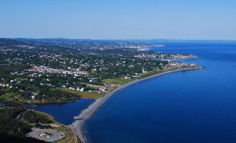
Placentia Bay, from the French plaisance (meaning a "pleasant place"), is a large, deep bay formed by Newfoundland's Burin Peninsula to the west, and the southwestern Avalon Peninsula to the east. From Ferryland Head in the west and Cape St Mary's 90 km east, the bay runs 125 km to its head, the Isthmus of Avalon. Ringed with coves and harbours, the bay has 2 extensive islands, Merasheen and Long, formerly populated, which divide the bay into channels to the north.
Once utilized by Dorset people and the Beothuk, the fine fishing grounds were probably first frequented by Basques and French in the 1500s; by the 1660s French fishermen occupied the bay, as modern place-names still attest. After the Treaty of Utrecht, 1713, when the French settlements were ceded to Britain, English use and settlement slowly followed in Placentia Bay.
Today the principal settlements are in the Burin- Marystown area and in the vicinity of Placentia and Argentia, once the location of a major US military facility and now the terminus of Marine Atlantic's ferry service to Nova Scotia. Fishing, shipbuilding and services are now the main employers. There is also a large oil refinery at Come by Chance.