Share on Facebook
 Share on X
 Share by Email
 Share on Google Classroom
")
")

Route
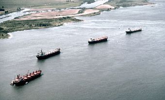
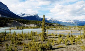
The Rouge River is a tributary of the Ottawa River. Its source is Lac de la Fougère, in the northeast part of Rouge-Matawin Wildlife Reserve in Québec. At an altitude of 550 metres, it winds 161 kilometres down through the Laurentian Mountains to the mouth of the Ottawa River at the head of Long-Sault, near Grenville-sur-la-Rouge, in the regional county municipality of Argenteuil (Laurentians). Criss-crossing through the lower part of the Canadian Shield, the Rouge owes its name to the presence of iron oxides in the surrounding rock. The Rapides des Sept Sœurs, a hotspot for rafting, cascade through the final escarpments of the Lower Laurentians.
History
Aboriginal Presence
Before the French arrived in North America, the Rouge River was part of the territory of the Algonquin, who controlled the area of the Ottawa River and its tributaries. They used a large beach at the confluence of the two rivers as their encampment during the summer. When winter fell, the Ouescharini (or people of the deer), an Algonquin tribe from the Petite-Nation valley, migrated between the Ottawa River and Lac Nominingue, in the Laurentians, passing through the Rouge valley.
The Rouge was nicknamed the “river of the Great Spirit.” In the traditional religion of the Algonquin, the spirit Manitou represented the power that inhabits all things in nature, both weak and strong, benevolent and malevolent. All along this navigable route, French explorers found themselves vulnerable to attacks from Iroquois bands. The large beach at the confluence of the Rouge and Ottawa rivers became one of the most dangerous places in the country. In 1696, Louis-Hector de Callière (governor of Montréal) and the Comte de Frontenac (governor general of New France) launched a major campaign against the Iroquois to end the reign of terror on the Ottawa led by the Onondaga chief, nicknamed Chaudière Noire (“Black Cauldron”) by the French.
Fur Trade
During the early years of Aboriginal and French occupation of the area, the Ottawa River was one of the main inland access routes and one of the most important trade routes in New France. The area of Argenteuil on the northern bank of the Ottawa became a trading region for Aboriginal and European founding peoples involved in the fur trade, attracting explorers in pursuit of wealth and land. In 1759, roughly 80 canoes per year (carrying a total of 600 to 700 men) went west in the spring and returned loaded with furs in the fall. Many Aboriginal and French coureurs des bois went along the Rouge to trap or trade. Steven Bevin, a former employee of the Hudson’s Bay Company who profited from the fur trade in the Rouge valley, built a trading post at the entrance to the river.
Forest Industry
In the first half of the 19th century, George Hamilton and his brothers Robert and William, from Hawkesbury, Ontario, controlled a large part of the forested land in the township of Grenville and in the Rouge valley. The river was used to transport wood for constructing buildings and ships for the British Empire (see Timber Trade History). Log drivers floated and directed logs to the mouth of the Rouge, then transported them either to mills in Grenville and Hawkesbury, or to Québec City in the form of frames (see Raft). In 1886, the Ottawa Lumber Company established a sawmill on this log-driving river. As of 1896, the mill employed more than 150 men. A true engine of economic development, the Rouge River reflected the image of a Canada under construction — modern, and founded on the exploitation of its natural resources.
Colonizing the Land
The valley of the Rouge became the birthplace of a migrant colony. In the first half of the 19th century, a great wave of Scottish and Irish immigrants flooded into Argenteuil. These people colonized the Rouge valley in two branches. The first went east via the Scotch Road and linked Grenville to Arundel; the second, to the west of the river, followed Avoca Road from Pointe-au-Chêne to the end of the hamlet of Avoca. The first arrivals in the township of Grenville were Scots following the settler Archibald McMillan. In 1859, surveyor Joseph Bouchette reported that the land in the Rouge valley was of high quality. In the northern part of the valley, colonization continued to spread along the Scotch Road and logging roads.
Hydroelectric Development
A river with great energy potential, the Rouge was marked as the future site of hydroelectric plants at the turn of the 20th century. The first dam was built at Table Rock falls in 1903, but it was later destroyed by flooding in the spring of 1933. In 1915, a dam and a hydroelectric station were built at Bell falls, in the north of Grenville township. The 10 MW station is still used today by Hydro-Québec.
Rouge River Today
In the early 1980s, the southern part of the Rouge transformed again, as the river’s relentless power started being used for extreme sports and leisure activities. A new class of thrill-seeking tourists began whitewater rafting on the river. The opportunities for recreational tourism put forward by rafting companies gave the Rouge River a new purpose.
Since 2009, the mission of the Organisme de bassins versants des rivières Rouge, Petite Nation et Saumon (OBV RPNS) (Organization of Watersheds of the Rouge, Petite Nation and Saumon Rivers) has been to ensure integrated water and environment management by rallying all stakeholders and users of the area, in a process of continuous consultation, planning and implementation. In 2015, the organization became a member of the AquaHacking Ottawa River Summit. The event, organized as part of the Mission Rivière project of the de Gaspé Beaubien Foundation, brought together various groups concerned about protecting the Ottawa River watershed.
The Rouge River is one of those iconic places whose potential has proven to be a determining factor in the socioeconomic development of the region. Due to its strategic importance during the French Regime — which was magnified by its significant historical role during the fur trade and by the boost in forest resource exploitation during Confederation — the Rouge has earned its places among the rivers that define Canadian identity.