Share on Facebook
 Share on X
 Share by Email
 Share on Google Classroom
Saint-Nicéphore
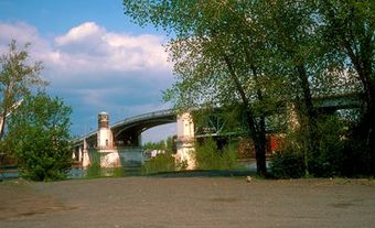
Saint-Nicéphore, Qué, Municipality, pop 9966 (2001c), 9251 (1996c), 8093 (1991c), 6537 (1986c), area 95.80 km2, inc 1944, is situated 9 km southeast of DRUMMONDVILLE. Rivère Saint-François extends along the east and much of the north boundaries of St-Nicéphore.The municipality has its origins from 2 lumber communities which developed in the early 1800s, Wheatland and Watkins Mill. In 1873, Tourville Lumber Mills arrived in the area and began purchasing land for trees it shipped to its sawmill in Pierreville, downstream on the Rivère Saint-François. By the end of the 19th century, this company owned 20% of present day St-Nicéphore.
In the mid-1800s, 3 large deposits of iron were discovered in the region, which helped diversify the economy. First incorporated as the village of East-Wickham in 1917 and then as the township of Wickham, it received it present name when it became a municipality in 1944. The municipality was named after Nicéphore Lessard, a Catholic priest who built the first church there in 1917.
Economic activity is centered along boulevard St-Joseph (also Highway 143) with the residential areas built on the periphery, but the majority of the land area is either rural or agricultural. Agriculture and manufacturing are the main economic activities.