Share on Facebook
 Share on X
 Share by Email
 Share on Google Classroom
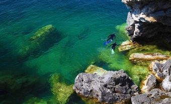
Texada Island, BC, 301 km2, pop 1089 (1991c) lies in the Strait of Georgia near Powell River. Texada Island was named for Felix de Texada, a Spanish rear-admiral, by explorer Jose Maria Narvaez (1791). In 1883 American capital started the first of several iron and copper-gold mines around the community of Van Anda near the island's north end. Mining was a mainstay until the 1920s and from World War II to 1976. A local smelter (1898) concentrated copper by-products; both ore and concentrates were shipped from deep-sea berths. Since about 1895 limestone quarries and lime kilns on the island have furnished material for cement, stucco, Kraft pulp and other off-island manufactures. Texada Island now produces most of British Columbia's limestone. The island's timber has been intensively logged since the 1940s. Most services on Texada Island are at the community of Gillies Bay.
-
- MLA 8TH EDITION
- Grant, Peter. "Texada Island". The Canadian Encyclopedia, 23 January 2014, Historica Canada. www.thecanadianencyclopedia.ca/en/article/texada-island. Accessed 24 April 2024.
- Copy
-
- APA 6TH EDITION
- Grant, P. (2014). Texada Island. In The Canadian Encyclopedia. Retrieved from https://www.thecanadianencyclopedia.ca/en/article/texada-island
- Copy
-
- CHICAGO 17TH EDITION
- Grant, Peter. "Texada Island." The Canadian Encyclopedia. Historica Canada. Article published March 09, 2008; Last Edited January 23, 2014.
- Copy
-
- TURABIAN 8TH EDITION
- The Canadian Encyclopedia, s.v. "Texada Island," by Peter Grant, Accessed April 24, 2024, https://www.thecanadianencyclopedia.ca/en/article/texada-island
- Copy
Thank you for your submission
Our team will be reviewing your submission
and get back to you with any further questions.
Thanks for contributing to The Canadian Encyclopedia.
CloseArticle
Texada Island
Article by Peter Grant
Published Online March 9, 2008
Last Edited January 23, 2014
Texada Island, BC, 301 km2, pop 1089 (1991c) lies in the Strait of Georgia near Powell River.