Cities & Populated Places | The Canadian Encyclopedia

Browse "Cities & Populated Places"

Displaying 511-525 of 963 results
  • Article

    Miramichi

    Miramichi, New Brunswick, incorporated as a city in 1995, population 17,537 (2016 census), 17,811 (2011 census). The City of Miramichi is in northeastern New Brunswick at the mouth of the Miramichi River, one of Canada's most famous salmon rivers.

    "https://d3d0lqu00lnqvz.cloudfront.net/media/media/177eafa5-be90-43c9-879c-7a35bbb3333f.jpg" // resources/views/front/categories/view.blade.php
    
    https://d3d0lqu00lnqvz.cloudfront.net/media/media/177eafa5-be90-43c9-879c-7a35bbb3333f.jpg Miramichi
  • Article

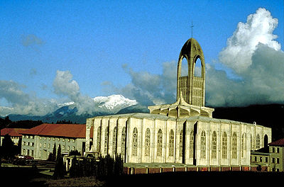
    Mission

    Mission, BC, incorporated as a district municipality in 1969, population 36 426 (2011c), 34 505 (2006c). The District of Mission is located on the north bank ofthe FRASER RIVER, 70 km by road east of VANCOUVER.

    "https://d3d0lqu00lnqvz.cloudfront.net/media/media/6232f070-823a-44e3-8285-5bb9d14cf197.jpg" // resources/views/front/categories/view.blade.php
    
    https://d3d0lqu00lnqvz.cloudfront.net/media/media/6232f070-823a-44e3-8285-5bb9d14cf197.jpg Mission
  • Article

    Mississauga

    Mississauga, Ontario, incorporated as a city in 1974, population 717,961 (2021 census), 721,599 (2016 census). The city was created by the amalgamation of the Town of Mississauga and the Towns of Port Credit and Streetsville. Located west of Toronto, Mississauga is part of the Regional Municipality of Peel. It is located within the Credit and Humber river watersheds. Throughout history, the Mississauga area has been home to different Indigenous groups, namely the Huron-Wendat, Haudenosaunee and Anishinaabeg, including the Mississauga. The land is covered by treaties 14, 19, 22 and 23.

    "https://d3d0lqu00lnqvz.cloudfront.net/media/new_article_images/Mississauga/SquareOne.jpg" // resources/views/front/categories/view.blade.php
    
    https://d3d0lqu00lnqvz.cloudfront.net/media/new_article_images/Mississauga/SquareOne.jpg Mississauga
  • Article

    Mistassini

    Mistassini, Qué, was a separate municipality (inc 1976) until it merged with Dolbeau to form the city of Dolbeau-Mistassini.

    "https://www.thecanadianencyclopedia.ca/images/tce_placeholder.jpg?v=e9dca980c9bdb3aa11e832e7ea94f5d9" // resources/views/front/categories/view.blade.php
    
    https://www.thecanadianencyclopedia.ca/images/tce_placeholder.jpg?v=e9dca980c9bdb3aa11e832e7ea94f5d9 Mistassini
  • Article

    Moncton

    Moncton, NB, incorporated as a city in 1890, population 71,889 (2016 census),69,074 (2011 census), is the largest city in New Brunswick. The City of Moncton is located in eastern New Brunswick on a bend of the Petitcodiac River. With a population of 144,810 (2016) the Greater Moncton region includes the steadily growing city of Dieppe and the town of Riverview.

    "https://www.thecanadianencyclopedia.ca/images/tce_placeholder.jpg?v=e9dca980c9bdb3aa11e832e7ea94f5d9" // resources/views/front/categories/view.blade.php
    
    https://www.thecanadianencyclopedia.ca/images/tce_placeholder.jpg?v=e9dca980c9bdb3aa11e832e7ea94f5d9 Moncton
  • Article

    Mont-Joli

    Further growth resulted from the establishment of train repair yards. The headquarters of the Canada and Gulf Terminal Ry (linking Mont-Joli and Matane) located in the village in 1910. These developments led to the opening of a foundry that produced railway equipment.

    "https://www.thecanadianencyclopedia.ca/images/tce_placeholder.jpg?v=e9dca980c9bdb3aa11e832e7ea94f5d9" // resources/views/front/categories/view.blade.php
    
    https://www.thecanadianencyclopedia.ca/images/tce_placeholder.jpg?v=e9dca980c9bdb3aa11e832e7ea94f5d9 Mont-Joli
  • Article

    Mont-Saint-Hilaire

    This area, part of the seigneury granted to Jean-Baptiste Hertel de Rouville in 1694, was sufficiently settled at the end of the 18th century to warrant the creation of a mission church, Saint-Hilaire.

    "https://www.thecanadianencyclopedia.ca/images/tce_placeholder.jpg?v=e9dca980c9bdb3aa11e832e7ea94f5d9" // resources/views/front/categories/view.blade.php
    
    https://www.thecanadianencyclopedia.ca/images/tce_placeholder.jpg?v=e9dca980c9bdb3aa11e832e7ea94f5d9 Mont-Saint-Hilaire
  • Article

    Montague

    While it still lacks an industrial base, the town has experienced renewed prosperity with the agricultural revitalization that began in the 1960s. Out-of-province investment established tobacco farms and rejuvenated the mixed- and dairy-farming industries.

    "https://www.thecanadianencyclopedia.ca/images/tce_placeholder.jpg?v=e9dca980c9bdb3aa11e832e7ea94f5d9" // resources/views/front/categories/view.blade.php
    
    https://www.thecanadianencyclopedia.ca/images/tce_placeholder.jpg?v=e9dca980c9bdb3aa11e832e7ea94f5d9 Montague
  • Article

    Montmagny

    Jacques CARTIER passed Montmagny and its many offshore islands in 1535 and noted its beautiful surroundings. In 1646 a seigneury containing the area was granted to Huault, although permanent European habitation did not begin until the 1670s.

    "https://d3d0lqu00lnqvz.cloudfront.net/media/media/6611985e-9eb7-4000-aa69-69a6aff45685.jpg" // resources/views/front/categories/view.blade.php
    
    https://d3d0lqu00lnqvz.cloudfront.net/media/media/6611985e-9eb7-4000-aa69-69a6aff45685.jpg Montmagny
  • Article

    Montreal

    Montreal, Quebec, incorporated as a city in 1832, population 1,762,949 (2021 census), 1,704,694 (2016 census). Montreal is Canada’s second largest city and is home to nearly half of the province of Quebec’s population. It is the metropolis of the province and was the most populous city in Canada for a century and a half. It is located in southwestern Quebec on Île de Montreal at the confluence of the St. Lawrence and Ottawa rivers. Montreal is a major industrial centre, commercial and financial metropolis, railway and maritime bridgehead, and one of the centres of francophone culture in North America. It is one of the world's great cities and enjoys international acclaim.

    "https://d3d0lqu00lnqvz.cloudfront.net/media/media/Downtown_MTL.jpg" // resources/views/front/categories/view.blade.php
    
    https://d3d0lqu00lnqvz.cloudfront.net/media/media/Downtown_MTL.jpg Montreal
  • Collection

    Montréal: 375 Years of History and Heritage

    On 17 May 1642, a group of French settlers led by Paul de Chomedey de Maisonneuve and Jeanne Mance established the missionary colony of Ville-Marie on the Island of Montréal. Today, this modest settlement founded in the middle of the St. Lawrence River is Canada’s second largest city and home to nearly half of the province of Québec’s population. A centre of francophone culture in North America, Montréal also enjoys international renown. Through exhibits, images...

    "https://d3d0lqu00lnqvz.cloudfront.net/media/media/6c00f298-5e17-4d87-8e49-c455a420812a.jpg" // resources/views/front/categories/view.blade.php
    
    https://d3d0lqu00lnqvz.cloudfront.net/media/media/6c00f298-5e17-4d87-8e49-c455a420812a.jpg Montréal: 375 Years of History and Heritage
  • Article

    Montréal-Est

    Montréal-Est owes its existence to Joseph Versailles, an important Montréal broker. In 1909 he bought 6 km2 of land in order to create a quiet and peaceful residential community. Heavy industry developed around the port and the community evolved away from Versailles's original vision.

    "https://www.thecanadianencyclopedia.ca/images/tce_placeholder.jpg?v=e9dca980c9bdb3aa11e832e7ea94f5d9" // resources/views/front/categories/view.blade.php
    
    https://www.thecanadianencyclopedia.ca/images/tce_placeholder.jpg?v=e9dca980c9bdb3aa11e832e7ea94f5d9 Montréal-Est
  • Article

    Montréal-Nord

    Montréal-Nord was created when it was detached from the parish municipality of Sault-aux-Récollets (1855). The area originally covered by Sault-aux-Récollets also included the Montréal districts of Ahuntsic and Saint-Michel, as well as the cities of Saint-Léonard and Anjou.

    "https://www.thecanadianencyclopedia.ca/images/tce_placeholder.jpg?v=e9dca980c9bdb3aa11e832e7ea94f5d9" // resources/views/front/categories/view.blade.php
    
    https://www.thecanadianencyclopedia.ca/images/tce_placeholder.jpg?v=e9dca980c9bdb3aa11e832e7ea94f5d9 Montréal-Nord
  • Article

    Montrose

    Montrose, BC, incorporated as a village in 1956, population 1030 (2011c), 1012 (2006c). The Village of Montrose is located in the West Kootenay district of southeastern British Columbia.

    "https://www.thecanadianencyclopedia.ca/images/tce_placeholder.jpg?v=e9dca980c9bdb3aa11e832e7ea94f5d9" // resources/views/front/categories/view.blade.php
    
    https://www.thecanadianencyclopedia.ca/images/tce_placeholder.jpg?v=e9dca980c9bdb3aa11e832e7ea94f5d9 Montrose
  • Article

    Moose Jaw

    Moose Jaw, Saskatchewan, incorporated as a city in 1903, population 33,665 (2021 census), 33,910 (2016 census). The city of Moose Jaw is located 160 km north of the US border and 65 km west of Regina in a sheltered valley at the confluence of the Moose Jaw River and Thunder Creek. It is governed by a mayor and six councillors who are elected to represent the city as a whole. The city’s evocative name is likely based on Indigenous sources and was perhaps first applied to a local creek that supposedly resembled the outline of a moose’s jawbone; another explanation is that it comes from a Cree word for “warm breezes.”

    "https://d3d0lqu00lnqvz.cloudfront.net/media/media/d752c9ca-404c-4d3f-906e-cb19fd13e9e6.jpg" // resources/views/front/categories/view.blade.php
    
    https://d3d0lqu00lnqvz.cloudfront.net/media/media/d752c9ca-404c-4d3f-906e-cb19fd13e9e6.jpg Moose Jaw