Article
Roblin
Roblin, Manitoba, incorporated as a village in 1913 and as a town in 1963, population 1774 (2011c), 1672 (2006c). The Town of Roblin is situated on Goose Lake 400 km northwest of Winnipeg near the Manitoba-Saskatchewan border.
Signing up enhances your TCE experience with the ability to save items to your personal reading list, and access the interactive map.
Create AccountArticle
Roblin, Manitoba, incorporated as a village in 1913 and as a town in 1963, population 1774 (2011c), 1672 (2006c). The Town of Roblin is situated on Goose Lake 400 km northwest of Winnipeg near the Manitoba-Saskatchewan border.
"https://d3d0lqu00lnqvz.cloudfront.net/media/media/4bdc8f29-c5bc-4346-8b69-eacb517ce926.jpg" // resources/views/front/categories/view.blade.phphttps://d3d0lqu00lnqvz.cloudfront.net/media/media/4bdc8f29-c5bc-4346-8b69-eacb517ce926.jpg

Article
Rockwood, Manitoba, incorporated as a rural municipality in 1880, population 7964 (2011c), 7692 (2006c). The Rural Municipality of Rockwood is located north of Winnipeg; it includes the communities of Stony Mountain, Grosse Isle, Argyle, Balmoral, Gunton and Komarno.
"https://www.thecanadianencyclopedia.ca/images/tce_placeholder.jpg?v=e9dca980c9bdb3aa11e832e7ea94f5d9" // resources/views/front/categories/view.blade.phphttps://www.thecanadianencyclopedia.ca/images/tce_placeholder.jpg?v=e9dca980c9bdb3aa11e832e7ea94f5d9

Article
Rocky Mountain House, Alberta, incorporated as a town in 1939, population 6,635 (2016 census), 6,933 (2011 census). The town of Rocky Mountain House is located on the North Saskatchewan River, 81 km west of Red Deer. It is near the site of the North West Company’s fur trade post of the same name.
"https://d3d0lqu00lnqvz.cloudfront.net/media/new_article_images/RockyMountainHouse/c007376.jpg" // resources/views/front/categories/view.blade.phphttps://d3d0lqu00lnqvz.cloudfront.net/media/new_article_images/RockyMountainHouse/c007376.jpg

Article
Rocky Mountain House National Historic Site, near Rocky Mountain House, Alberta, commemorates a series of fur-trade posts built between 1799 and 1864 by the North West Co and the Hudson's Bay Co (HBC) near the junction of the North Saskatchewan and Clearwater rivers.
"https://www.thecanadianencyclopedia.ca/images/tce_placeholder.jpg?v=e9dca980c9bdb3aa11e832e7ea94f5d9" // resources/views/front/categories/view.blade.phphttps://www.thecanadianencyclopedia.ca/images/tce_placeholder.jpg?v=e9dca980c9bdb3aa11e832e7ea94f5d9
Article
The Rocky Mountain Trench is a long and deep valley extending approximately 1,500 km from the Bitterroot Valley in northwest Montana through British Columbia to the Liard Plain just south of the Yukon Territory. Its predominantly flat floor is 3–20 km wide and ranges in elevation between 600 m and 1,000 m above sea level. With walls made of sedimentary, volcanic and igneous rock, the Trench is sometimes referred to as the “Valley of a Thousand Peaks” because of the towering mountain ranges on either side: the Rocky Mountains to the east and the Columbia, Omineca and Cassiar mountains to the west. Humans have relied on the rich resources provided by this distinctive landscape from pre-colonial times to the present.
"https://d3d0lqu00lnqvz.cloudfront.net/media/media/061fe992-a3bf-45bc-906d-216d1bef45c7.jpg" // resources/views/front/categories/view.blade.phphttps://d3d0lqu00lnqvz.cloudfront.net/media/media/061fe992-a3bf-45bc-906d-216d1bef45c7.jpg

Article
Castlelike mountain resorts built on the rail line at Banff and Lake Louise have become all-season recreation centres for Banff National Park's (established 1885) many alpine attractions, which attract 4.5 million visitors annually.
"https://d3d0lqu00lnqvz.cloudfront.net/media/media/ebac2147-4f0e-4324-844b-afdbfd364b52.jpg" // resources/views/front/categories/view.blade.phphttps://d3d0lqu00lnqvz.cloudfront.net/media/media/ebac2147-4f0e-4324-844b-afdbfd364b52.jpg

Article
During the summer of 1885 the railway was constructed over the pass at great expense. Over 6.4 km of snowsheds (31) were built to protect trains, trackage and workmen from AVALANCHES (the area receives up to 15 m of snow each winter).
"https://d3d0lqu00lnqvz.cloudfront.net/media/media/4a73903a-ec12-49d4-86cb-2a9cbd3c3f23.jpg" // resources/views/front/categories/view.blade.phphttps://d3d0lqu00lnqvz.cloudfront.net/media/media/4a73903a-ec12-49d4-86cb-2a9cbd3c3f23.jpg

Article
Rondeau Provincial Park (established 1894, 33 km2) provides environmental protection and recreation on one of 3 peninsulas jutting south into Lake ERIE. It lies 120 km east of Windsor and 115 km southwest of London.
"https://www.thecanadianencyclopedia.ca/images/tce_placeholder.jpg?v=e9dca980c9bdb3aa11e832e7ea94f5d9" // resources/views/front/categories/view.blade.phphttps://www.thecanadianencyclopedia.ca/images/tce_placeholder.jpg?v=e9dca980c9bdb3aa11e832e7ea94f5d9
Article
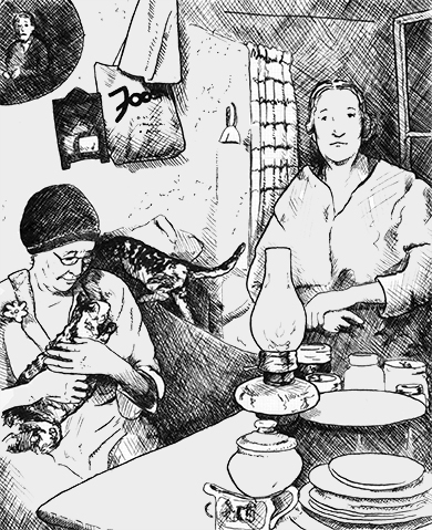
Rooster Town was a largely Métis community that existed on the southwest fringes of suburban Winnipeg from 1901 until the late 1950s. While there were numerous urban Métis fringe communities on the Prairies and in British Columbia, their history has been relatively forgotten. (See also Métis Road Allowance Communities.)
"https://d3d0lqu00lnqvz.cloudfront.net/media/media/093c5c4d-cdd7-4fe5-b8d1-753c6c5a7dd9.jpg" // resources/views/front/categories/view.blade.phphttps://d3d0lqu00lnqvz.cloudfront.net/media/media/093c5c4d-cdd7-4fe5-b8d1-753c6c5a7dd9.jpg
Article
In 1880, Rosemère was primarily an agricultural community. The beauty of the Laurentides region was later discovered and Rosemère established itself as a holiday destination.
"https://d3d0lqu00lnqvz.cloudfront.net/media/media/da9a5d37-763c-4f26-9866-1b7c4350f63e.jpg" // resources/views/front/categories/view.blade.phphttps://d3d0lqu00lnqvz.cloudfront.net/media/media/da9a5d37-763c-4f26-9866-1b7c4350f63e.jpg

Article
Rosetown, Sask, incorporated as a town in 1911, population 2317 (2011c), 2277 (2006c). The Town of Rosetown is located 115 km southwest of SASKATOON. It is a focal point for the major transportation routes of the region and is
"https://www.thecanadianencyclopedia.ca/images/tce_placeholder.jpg?v=e9dca980c9bdb3aa11e832e7ea94f5d9" // resources/views/front/categories/view.blade.phphttps://www.thecanadianencyclopedia.ca/images/tce_placeholder.jpg?v=e9dca980c9bdb3aa11e832e7ea94f5d9
Article
Ross Farm, at New Ross, NS, 28 km north of Chester, dates from 1816, when Captain William Ross led 172 disbanded soldiers into the Nova Scotia interior to establish an agricultural settlement.
"https://www.thecanadianencyclopedia.ca/images/tce_placeholder.jpg?v=e9dca980c9bdb3aa11e832e7ea94f5d9" // resources/views/front/categories/view.blade.phphttps://www.thecanadianencyclopedia.ca/images/tce_placeholder.jpg?v=e9dca980c9bdb3aa11e832e7ea94f5d9
Article
Ross River, Yukon, settlement, population 293 (2016 census), 352 (2011 census). Ross River is located at the confluence of the Ross and Pelly rivers. It is on the Canol Road (seeCanol Pipeline) at the halfway point on the Campbell Highway. Ross River is 360 km by road northeast of Whitehorse.
"https://www.thecanadianencyclopedia.ca/images/tce_placeholder.jpg?v=e9dca980c9bdb3aa11e832e7ea94f5d9" // resources/views/front/categories/view.blade.phphttps://www.thecanadianencyclopedia.ca/images/tce_placeholder.jpg?v=e9dca980c9bdb3aa11e832e7ea94f5d9
Article
The Ross-Thomson House is located in SHELBURNE, NS. At the end of the American Revolution, thousands of LOYALISTS arrived in Shelburne. Many quickly left, but others, like George and Robert Ross, settled and began businesses in the new town.
"https://www.thecanadianencyclopedia.ca/images/tce_placeholder.jpg?v=e9dca980c9bdb3aa11e832e7ea94f5d9" // resources/views/front/categories/view.blade.phphttps://www.thecanadianencyclopedia.ca/images/tce_placeholder.jpg?v=e9dca980c9bdb3aa11e832e7ea94f5d9
Article
Rossland, BC, incorporated as a city in 1897, population 4,140 (2021 census), 3,729 (2016 census). The City of Rossland is located 10 km southwest of Trail in the eroded crater of a long-extinct volcano of the Monashee Mountains.
"https://www.thecanadianencyclopedia.ca/images/tce_placeholder.jpg?v=e9dca980c9bdb3aa11e832e7ea94f5d9" // resources/views/front/categories/view.blade.phphttps://www.thecanadianencyclopedia.ca/images/tce_placeholder.jpg?v=e9dca980c9bdb3aa11e832e7ea94f5d9