Article
Mount Vancouver
Mount Vancouver, elevation 4785 m, situated in the Yukon Territory's St Elias Mountains, rises southeast of Mount Logan between 2 immense glacier systems, Hubbard and Seward.
Signing up enhances your TCE experience with the ability to save items to your personal reading list, and access the interactive map.
Create AccountArticle
Mount Vancouver, elevation 4785 m, situated in the Yukon Territory's St Elias Mountains, rises southeast of Mount Logan between 2 immense glacier systems, Hubbard and Seward.
"https://www.thecanadianencyclopedia.ca/images/tce_placeholder.jpg?v=e9dca980c9bdb3aa11e832e7ea94f5d9" // resources/views/front/categories/view.blade.phphttps://www.thecanadianencyclopedia.ca/images/tce_placeholder.jpg?v=e9dca980c9bdb3aa11e832e7ea94f5d9

Article
Mount Waddington, elev 4016 m, the highest mountain in BC's Coast Mountains, rises near the head of Knight Inlet, 282 km NW of Vancouver.
"https://www.thecanadianencyclopedia.ca/images/tce_placeholder.jpg?v=e9dca980c9bdb3aa11e832e7ea94f5d9" // resources/views/front/categories/view.blade.phphttps://www.thecanadianencyclopedia.ca/images/tce_placeholder.jpg?v=e9dca980c9bdb3aa11e832e7ea94f5d9
Article
Mountain ranges generally belong to the same geological structure, and consist of a series of peaks and ridges surrounded by lowlands and valleys. There are many mountain ranges in Canada, including the Rocky Mountains, the St. Elias Mountains and the Laurentian Mountains.
"https://d3d0lqu00lnqvz.cloudfront.net/media/media/ebac2147-4f0e-4324-844b-afdbfd364b52.jpg" // resources/views/front/categories/view.blade.phphttps://d3d0lqu00lnqvz.cloudfront.net/media/media/ebac2147-4f0e-4324-844b-afdbfd364b52.jpg

Article
Mountains. As an inspiration for Canadian music, mountains have enjoyed limited popularity. Not unexpectedly the mountains most often referred to are the Rockies of Alberta and British Columbia.
"https://www.thecanadianencyclopedia.ca/images/tce_placeholder.jpg?v=e9dca980c9bdb3aa11e832e7ea94f5d9" // resources/views/front/categories/view.blade.phphttps://www.thecanadianencyclopedia.ca/images/tce_placeholder.jpg?v=e9dca980c9bdb3aa11e832e7ea94f5d9
Article
Muskeg (from Cree maskek and Ojibwe mashkiig, meaning “grassy bog”) is a type of northern landscape characterized by a wet environment, vegetation and peat deposits. Chiefly used in North America, the term muskeg escapes precise scientific definition. It encompasses various types of wetlands found in the boreal zone, including bogs, fens, swamps and mires. In Canada, muskeg and other peatlands cover up to 1.2 million km2, or 12 per cent of the country’s surface.
"https://d3d0lqu00lnqvz.cloudfront.net/media/new_article_images/Muskeg/Muskeg 1.jpg" // resources/views/front/categories/view.blade.phphttps://d3d0lqu00lnqvz.cloudfront.net/media/new_article_images/Muskeg/Muskeg 1.jpg

Article
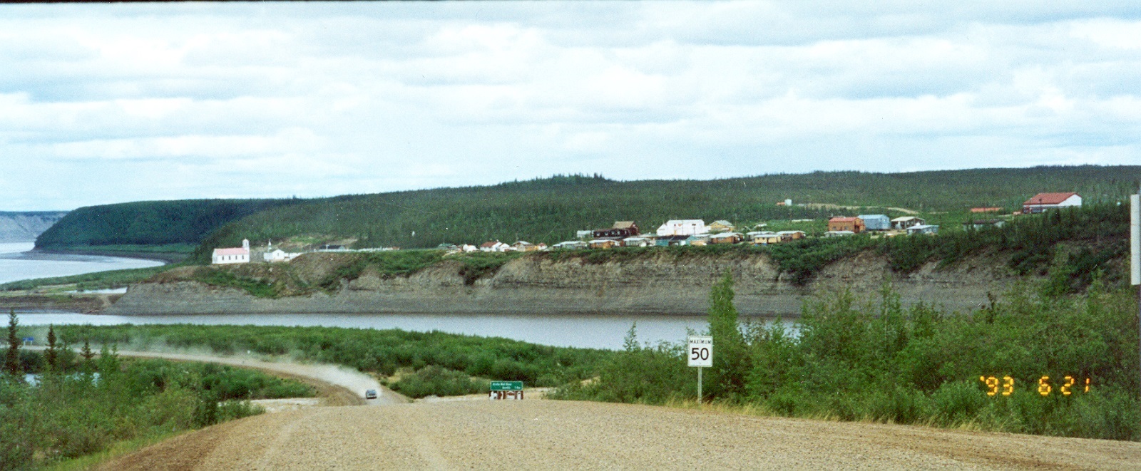
Nagwichoonjik, meaning "river flowing through a big country," is the Gwich'in name for the Mackenzie River, the longest river in Canada and the 9th longest river in the world. The river flows through the heart of the traditional homeland of the Gwichya Gwich'in, who now largely reside in Tsiigehtchic (formerly Arctic Red River), a small community of 200 people at the confluence of the Arctic Red and Mackenzie rivers, in the northern part of the Northwest Territories. ( See also Indigenous Territory).
"https://d3d0lqu00lnqvz.cloudfront.net/media/new_article_images/Tsiigehtchic/TsiigehtchicBothRivers.jpg" // resources/views/front/categories/view.blade.phphttps://d3d0lqu00lnqvz.cloudfront.net/media/new_article_images/Tsiigehtchic/TsiigehtchicBothRivers.jpg
Article
Napaktulik Lake, 1080 km2, elevation 381 m, maximum length 60 km, is located in Nunavut almost on the Arctic Circle, 173 km south of Kugluktuk, NWT. The lake is fed by a tributary of the COPPERMINE RIVER and drains northeast to BATHURST INLET via the Hood River.
"https://www.thecanadianencyclopedia.ca/images/tce_placeholder.jpg?v=e9dca980c9bdb3aa11e832e7ea94f5d9" // resources/views/front/categories/view.blade.phphttps://www.thecanadianencyclopedia.ca/images/tce_placeholder.jpg?v=e9dca980c9bdb3aa11e832e7ea94f5d9
Article
Nass River is 380 km long, rises in the northern interior of BC and flows generally southwest, draining approximately 20 700 km2, to reach the Pacific at Portland Inlet. Its major tributaries are the Bell-Irving, Meziadin and Cranberry rivers.
"https://d3d0lqu00lnqvz.cloudfront.net/media/media/98c7f804-42d2-47dd-a13b-335cd43c959f.jpg" // resources/views/front/categories/view.blade.phphttps://d3d0lqu00lnqvz.cloudfront.net/media/media/98c7f804-42d2-47dd-a13b-335cd43c959f.jpg

Article
Navy Island is the only Canadian island in the Niagara River. The 127.9 ha island is named after a British shipyard (1793) where the first naval vessels to sail the Upper Great Lakes were constructed.
"https://www.thecanadianencyclopedia.ca/images/tce_placeholder.jpg?v=e9dca980c9bdb3aa11e832e7ea94f5d9" // resources/views/front/categories/view.blade.phphttps://www.thecanadianencyclopedia.ca/images/tce_placeholder.jpg?v=e9dca980c9bdb3aa11e832e7ea94f5d9
Article
The Nechako River rises in the Coast Mountains in west-central BC and flows east to form a principal tributary of the Fraser River. Because of massive damming of its headwaters, it is no longer possible to give its length or tell exactly where it used to rise.
"https://d3d0lqu00lnqvz.cloudfront.net/media/media/2ba613f3-f597-4da8-93a3-b376b6e74bec.jpg" // resources/views/front/categories/view.blade.phphttps://d3d0lqu00lnqvz.cloudfront.net/media/media/2ba613f3-f597-4da8-93a3-b376b6e74bec.jpg

Article
The Nelson River, 2,575 km long, flows north northeast out of Playgreen Lake, at the northwest tip of Lake Winnipeg. It spills out into a number of lakes, including Cross, Sipiwesk, Split and Stevens, flowing east from the latter into Hudson Bay.
"https://www.thecanadianencyclopedia.ca/images/tce_placeholder.jpg?v=e9dca980c9bdb3aa11e832e7ea94f5d9" // resources/views/front/categories/view.blade.phphttps://www.thecanadianencyclopedia.ca/images/tce_placeholder.jpg?v=e9dca980c9bdb3aa11e832e7ea94f5d9
Article
Nettilling Lake, 5,542 km2, elevation 30 m, max length 123 km, is located toward the south end of Baffin Island. The lake is in the Great Plain of the Koukdjuak, about 110 km southwest of Auyuittuq National Parkand 280 km northwest of Iqaluit. The name is of Inuktitut origin but its meaning is unclear. (See also Largest Lakes in Canada.)
"https://www.thecanadianencyclopedia.ca/images/tce_placeholder.jpg?v=e9dca980c9bdb3aa11e832e7ea94f5d9" // resources/views/front/categories/view.blade.phphttps://www.thecanadianencyclopedia.ca/images/tce_placeholder.jpg?v=e9dca980c9bdb3aa11e832e7ea94f5d9
Article
New Caledonia ("New Scotland"), was a name given in 1806 to the central and highland plateau area of BRITISH COLUMBIA by Simon FRASER, a partner, trader and explorer in the NORTH WEST CO.
"https://www.thecanadianencyclopedia.ca/images/tce_placeholder.jpg?v=e9dca980c9bdb3aa11e832e7ea94f5d9" // resources/views/front/categories/view.blade.phphttps://www.thecanadianencyclopedia.ca/images/tce_placeholder.jpg?v=e9dca980c9bdb3aa11e832e7ea94f5d9
Article
The Niagara Escarpment, in its Ontario portion, is 725 km long, covering 1923 km2, with a maximum height of 335 m.
"https://d3d0lqu00lnqvz.cloudfront.net/media/media/5e74cb9f-53c2-453f-8ffd-322cbcf683cb.jpg" // resources/views/front/categories/view.blade.phphttps://d3d0lqu00lnqvz.cloudfront.net/media/media/5e74cb9f-53c2-453f-8ffd-322cbcf683cb.jpg

Article
Niagara Falls, a spectacular waterfall in the Niagara River, is the world’s greatest waterfall by volume at 2,832 m3. It is split in two by Goat Island. The American Falls are 59 m high (21–34 m to rock debris at the base of the falls) and 260 m wide and carry about 10 per cent of the flow. The Canadian, or Horseshoe, Falls are 54 m high and 670 m wide, with the remaining 90 per cent of the flow. However, only the Canadian Falls fall freely to the Maid-of-the-Mist pool, where they have excavated a basin as deep or deeper than they are tall. The falls were formed some 14,000 years ago as retreating glaciers exposed the Niagara Escarpment, permitting the waters of Lake Erie, which formerly drained south, to flow northward into Lake Ontario.
"https://d3d0lqu00lnqvz.cloudfront.net/media/media/6ee4c921-2ba5-47cb-bfc5-8eebd83e3d65.jpg" // resources/views/front/categories/view.blade.phphttps://d3d0lqu00lnqvz.cloudfront.net/media/media/6ee4c921-2ba5-47cb-bfc5-8eebd83e3d65.jpg
