Share on Facebook
 Share on X
 Share by Email
 Share on Google Classroom
Mapping in Canada in the 1600s began with the work of Samuel de Champlain. He produced the first modern-looking map of Eastern Canada in 1613, and the most comprehensive of his maps in 1632. For much of the 1600s and early 1700s, the French were the primary cartographers of what would become Canada. Notable exceptions include the English’s mapping of the Arctic (see also Cartography in Canada: 1500s) and Henry Hudson and other’s work in mapping Hudson Bay. The Seven Years' War (1756–63) interrupted mapping activity in Canada.
")
Samuel de Champlain
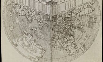
In 1613, Samuel de Champlain published the first modern-looking map of Eastern Canada (see also Cartography in Canada: 1500s). The map combined his own explorations with those of Henry Hudson. By 1616, he had explored and mapped as far west as Georgian Bay. For other areas, he used Indigenous maps and verbal accounts (see also Cartography in Canada: Indigenous Mapmaking). His observations were made from compass and latitude readings as well as estimates of distance. Besides his six small-scale maps, of which that of 1632 is the most comprehensive, Champlain also produced 23 large-scale maps and picture plans of places between Cape Cod and Montreal.
Jesuit Missionaries
From the time of Samuel de Champlain’s death in 1635 to the 1670s, the major explorers furnishing geographical information to European cartographers were Jesuit missionaries. By 1649, they had explored the eastern Great Lakes. Maps made by Father Nicolas Sanson in 1650 and 1656, Father François-Joseph Bressani in 1657, and Father François Du Creux in 1660 have all survived in printed form. On these maps the Great Lakes were recognizable for the first time.
Further Jesuit mapping led to the first good map of Lake Superior and northern Lake Michigan in 1672 by Father Claude Allouez and Father Claude Dablon. Father Jacques Marquette and Louis Jolliet created the first delineation of the Mississippi River in 1673. Father Pierre Raffeix and others also created a series of maps of Haudenosaunee country in upper New York State during this time.
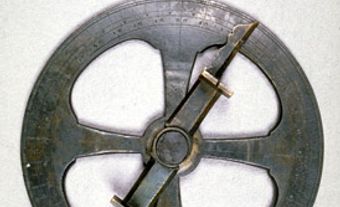
One of the few non-Jesuit maps of the period was created by the Sulpician Bréhant de Galinée in 1670. It detailed his journey with François Dollier from Montreal through the lower Great Lakes to Sault Ste Marie. The necessary observations used to construct all these maps were similar to those used for Samuel de Champlain’s. In 1632, the Jesuits began to observe and, later, to time lunar eclipses to establish longitude west of Paris or Rome.
Late 1600s
From the 1670s to the end of the century, the mapping of Canada was primarily associated with Louis Jolliet and Jean-Baptiste-Louis Franquelin, the latter being the more talented draftsman. He held the position of king’s hydrographer for the colony of Quebec from 1686 to 1697 and from 1701 to 1703, teaching hydrography and keeping the maps of New France up to date.
The manuscript maps of explorers such as René-Robert Cavelier de La Salle, Jolliet and a number of military surveyors were incorporated in large compilations sent to France, where professional cartographers had access to them. The chief cartographers to the French court, such as Vincenzo Coronelli and Guillaume Delisle, based their printed maps in part on the information furnished by Franquelin.
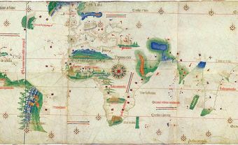
The maps of Vincenzo Maria Coronelli (1688–89) and Guillaume Delisle (1703) best sum up late 17th-century cartography of Canada. The Delisle map also has the distinction of being the first with a fairly modern grid of longitude based on a lunar eclipse recorded at Quebec City in 1685 by Jean Deshayes.
Large-scale mapping during the 17th century was understandably confined to the St. Lawrence River valley. Cadastral mapping (i.e., mapping of property boundaries, building locations, etc.) started with Jean Bourdon’s mapping of seigneuries in 1641. In 1660, Bourdon also produced an early plan of Quebec City. The St. Lawrence River was charted by Jolliet and Franquelin in 1685, but much more competently by Deshayes in 1685–86.
Early 1700s
Although the printed results of Jean Deshayes’s survey (1702) became the standard chart of the St. Lawrence River, Testu de la Richardière undertook a more accurate survey in 1730–41 and Gabriel Pellegrin in 1734–55. Cadastral maps also continued to be produced during the 18th century; one of the most notable was created by Jean-Baptiste Decouagne in 1709. These maps and charts were all constructed by competent surveyors and military engineers using up-to-date instruments and surveying principles.
Increasingly strained relations with England made the activities of French military engineers more important in the 18th century. Engineer Gaspard-Joseph Chaussegros de Léry and his son of the same name charted the lower Great Lakes with some accuracy. They also prepared maps of Quebec and major fortifications from Louisbourg to Detroit.
On the East Coast, Joseph Bernard de Chabert made one of the first accurate hydrographic surveys in 1750–51. In 1750, he built Canada’s first observatory at Louisbourg for astronomical observation and longitude calculation.
")
While the settled and strategic areas of New France were being charted by trained engineers and surveyors, the interior was still being mapped by amateurs with little training and no instruments more sophisticated than a compass. The first maps of the region west of Lake Superior resulted from Pierre Gaultier de Varennes et de La Vérendrye’s expeditions after 1731, while the northern interior of Quebec was being mapped by the Jesuit Father Pierre-Michel Laure. These maps portray a recognizable lake and river system.
Very little 18th-century manuscript mapping found its way to printed maps until Jacques-Nicolas Bellin became chief engineer and geographer of the Dépôt des cartes, plans et journaux of the French Ministère de la Marine. In 1744, he published 28 maps in Father Pierre-François-Xavier de Charlevoix’s combined Histoire and Journal (1744). These were the first printed maps of Canada based on new material since Guillaume Delisle’s of 40 years earlier.
In succeeding years, Bellin regularly updated his maps. Another important cartographer, Jean-Baptiste Bourguignon D’Anville, like Bellin, had access to original material. He produced a series of fine maps between 1746 and 1755. Both cartographers published pamphlets explaining their source material and the reliability of their maps.
")
English Mapmaking
Primary English mapping of Canada before 1763 was confined entirely to the Arctic and the shores of Hudson Bay. Henry Hudson’s 1612 map of the bay’s east shore and the straits was quickly replaced by maps of the entire bay by Thomas James in 1633 and Luke Fox. John Thornton produced a more accurate chart for the Hudson’s Bay Company in 1685.
The HBC did no more mapping until Arthur Dobbs criticized the company for its dismal record in exploration. Beginning in 1741, expeditions resulted in a series of excellent charts by Christopher Middleton (1743), John Wigate (1746) and Henry Ellis (1748) as far north as Repulse Bay.
In 1756, the Seven Years’ War interrupted mapping activities in New France. The last French map of North America, summarizing the latest geographical information available on Canada before it passed into British hands, was Jacques-Nicolas Bellin’s “Carte de l’Amérique septentrionale” in 1755. It shows that Canada had been mapped, roughly but recognizably, to about 102° W in present-day Manitoba and along the western shore of Hudson Bay to the Arctic Circle.