Share on Facebook
 Share on X
 Share by Email
 Share on Google Classroom
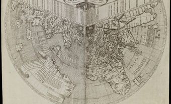
Mapmaking was a widespread and well-developed art among Indigenous peoples in what is now Canada. However, this fact has been largely ignored in the history of cartography. Most common were navigational maps, because the more nomadic hunting and gathering bands depended on effective navigation over great expanses of wilderness. Indigenous peoples also drew maps to facilitate trade and warfare over long distances. Groups, in particular the equestrian Plains Indigenous people, used military maps to venture into the unfamiliar regions. (See also History of Cartography in Canada.)
Methods
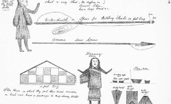
Indigenous navigational maps were usually drawn on the ground or in the snow. Sketched from memory, they were accompanied by verbal descriptions of the country in question. They were thus ephemeral and, in contrast to the European use of maps, required the successful traveller to rely entirely upon memory. Indigenous people were trained in this task from childhood.
When a map was committed to media that dictated its size, such as skins or bark, no attempt was made to fill in the entire space. Instead, detail was elaborated only where necessary. Lakes, rivers and shorelines were accurately portrayed on most Indigenous maps. In this respect they differ little from modern survey maps. Scale, however, was often measured by the day’s journey, and hence varied according to factors affecting travel time. Scale was also varied to exaggerate or clarify significant features for navigation.
Europeans frequently found these maps overly simplified and confusing. However, they were eminently suited to the overriding objective of most Indigenous cartography: to accentuate landmarks and indicate features such as rapids and portages in order to aid travellers.

Cultural Significance
Indigenous maps were also used as repositories of cultural life and lore. Shawnadithit, for example, drew a series of maps to illustrate the history of her tribe, the Beothuk, in the years leading up to its extinction. Maps also recalled historical events such as battles. In addition, the Ojibwa elaborated charts to record their earlier migrations and past sacred events.
Communication
Combined with pictographs, Indigenous people also used maps for general communication. This communication was most commonly in the form of notices of direction and of trips. It also came in the form of missives that might properly be called “map letters.” In these ways, Indigenous people communicated crucial geographical information to their fellows. In the same way, maps made by Indigenous people afforded early European explorers, traders and missionaries much of the geographical information that eventually carried them from the Atlantic to the Pacific and into the Arctic.