Share on Facebook
 Share on X
 Share by Email
 Share on Google Classroom
New Brunswick is part of the Appalachian region, one of Canada’s seven physiographic regions. The province’s principal geographic divisions are the watershed of the Bay of Fundy, centering on the Saint John River valley, and the north and east shores. The residents of the north and east shores live in coastal fishing villages and interior lumbering settlements along rivers. They are separated physically from the valley communities by uplands and belts of forest. They are also separated culturally by their predominantly French language and Catholic religion.

Geology
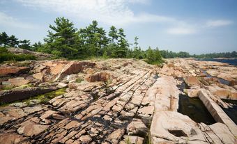
New Brunswick’s rock foundation was largely formed in the Palaeozoic era (541–251.9 million years ago). It was part of a geological formation extending from the southeastern US to Newfoundland. Ocean deposits of the Ordovician period (485.4–443.8 million years ago) created much of the rock in northern and western New Brunswick. These rocks were folded, intruded with granites, and overlain with lavas, reflecting sporadic volcanic activity throughout the Palaeozoic era. They contain the zinc, lead and copper deposits of the Bathurst to Newcastle area.
Folding, faulted movements and volcanic activity reached a climax over 350 million years ago during the Acadian Orogeny. Much of the base of the central and eastern parts of the province originated in the later Carboniferous period (ending 298.9 million years ago). Rocks of this period were formed in rivers, swamps and shallow basins. These included red, green and grey sandstones, some of which are coal-bearing. They also included conglomerates and isolated deposits of limestone, gypsum, salt and oil-bearing shale.
Surface

New Brunswick topography is characterized by northern uplands rising to 820 m and mountainous in appearance. There are gently rolling hills in the central and eastern parts of the province. Sharp hills on the southern coast slope down to tidal marshes and a lowland plain in the southeast.
The soils tend to be thin and acidic over the uplands, deeper but frequently poorly drained and acidic in the centre and west, and rocky in portions of the south. The best soils for agriculture tend to lie along the rivers. The upper Saint John River is flanked by low plateaus of well-drained sandy loam with good lime content. This soil is excellent for growing potatoes. The finely textured soils of the Fundy lowlands are also suitable for agriculture.
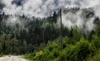
About 5 per cent of the province is farmland. Most of the remainder of the province, some 83 per cent, is under forest cover. Almost all of the forest cover is considered suitable for forestry. Spruce and fir are the leading softwoods, followed in importance by cedar and white pine. Jack pine, red pine, hemlock and larch are also present. Important hardwoods include red and sugar maples, poplar, white and yellow birch, and beech. Other hardwoods include ash, elm, hop hornbeam and red oak.
Water
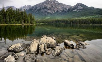
No part of New Brunswick is more than 180 km from the ocean. The ocean was the principal means of early transportation. An extensive river system brought access well into the interior of the province, permitting early development of the timber trade and dictating patterns of settlement. The largest cities are located on the rivers, as are most of the towns and villages. Lakes are common in the south, with the largest, Grand Lake, more than 30 km in length.
Climate
New Brunswick’s climate tends to be continental, though tempered by proximity to the ocean. It is harshest in the northwest, where more than one-third of precipitation comes as snow, and temperatures are several degrees colder than the central interior. The high temperature in Fredericton in January is -4°C while the low is -15°C. Fredericton’s summers are much warmer, reaching an average high of 25°C and low of 13°C in July.
Coastal communities are several degrees warmer in winter and slightly cooler in summer. The annual precipitation rate is about 1,078 mm. Precipitation is fairly evenly distributed throughout the province. That said, the highest precipitation rate occurs in the southeast.
Conservation

Forests are the focal point of conservation efforts in the province. Forest management has evolved considerably since the province first gained control over its crown lands in 1837. New Brunswick’s forest management system is now considered one of the best in Canada. At first, trees were considered a commodity with controlled harvests. Then, in the mid-1960s, forestry practices changed to the cultivation of the forests. Later forest management evolved to an integrated and sustainable approach where other factors, such as recreation and wildlife preservation, are also considered. (See also Environmental Movement in Canada.)
New Brunswick has nine provincial parks, including Mount Carleton Provincial Park. It is also home to two national parks, Fundy National Park and Kouchibouguac National Park.