Share on Facebook
 Share on X
 Share by Email
 Share on Google Classroom
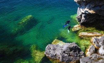
Meares Island, 84.8 km2 of dramatic terrain, temperate rain forest and sheltered tidal waters, is 2 km from Tofino, BC, in Clayoquot Sound. It was named in 1862 after John Meares. Its traditional name is Wanachus-Hilthuuis, from the Nuu-chah-nulth language.
History
The Indigenous village of Opitsat is on the island. According to oral and botanical records, Meares Island's resources were long utilized by the Nuu-chah-nulth (Nootka), particularly by the Tla-o-qui-aht and Ahousaht peoples. It has ancient western red cedar trees (a backbone of traditional West Coast crafts and technologies) and many other plant species. The island also has salmon runs in small rivers, wildlife, waterfowl and abundant intertidal foods, especially in the extensive mud flats of Lemmens Inlet.
Two rugged slopes (792 m and 730 m) provide drinking water and a scenic backdrop to Tofino District and, between them, marine habitat suitable for extensive mariculture.
Timber licences for Meares Island were first granted in 1905, and a small sawmill operated in Mosquito Harbour. In 1955, most of the island's forests were incorporated in two Tree Farm Licences, and massive clear-cutting began in the Clayoquot Sound. Following a public planning team study, MacMillan Bloedel Ltd obtained permits to log on Meares Island. However, in November 1984, protesters blocked the first loggers, the two bands declaring the island a Tribal Park. In 1985, the Nuu-chah-nulth were granted a court injunction to halt logging until their land claim was settled. This issue was part of comprehensive treaty negotiations between the Nuu-chah-nulth and the province of British Columbia.
Today, the Meares Island Tribal Park is under the stewardship of the Tla-o-qui-aht Tribal Park Guardians.