Share on Facebook
 Share on X
 Share by Email
 Share on Google Classroom
Indigenous Peoples
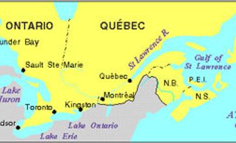
Prior to European contact, the territory around the northern Great Lakes, including Manitoulin Island, was controlled by a loose confederacy of Anishinaabeg peoples: the Odawa, Ojibwe and Potawatomi. Their alliance was known as the Three Fires Confederacy. The Odawa called the island Mnidoo Mnis, meaning “island of the Great Spirit.” The Odawa believed that Mnidoo or Manitou dwelt on the island. Jesuit missionaries arrived in 1648, but their mission was short-lived. The island was sporadically inhabited until the 1830s, when Sir Francis Bond Head tried to convince First Nations in Upper Canada to settle there.
While many First Nations were unwilling to move to the island, there were farmers who were. A shortage of farmland elsewhere in the province meant many farmers were eager to cultivate the island. The government realized that in order to open the island up to white settlement, First Nations needed to cede the land. In 1862, William McDougall, Superintendent General of Indian Affairs, visited Manitoulin Island to negotiate a treaty.
Wiikwemkoong First Nation refused to sign McDougall’s treaty. Other bands, however, did sign the agreement, which is referred to as the Manitoulin Island Treaty, 1862; the McDougall Treaty; or Treaty 94. The treaty ceded the majority of Manitoulin and the surrounding islands to the government. In exchange, First Nations received reserves. Five reserves, as well as Wiikwemkoong’s unceded land on the island’s eastern peninsula, were set aside. In addition to Wiikwemkoong, the First Nations on the island are: Sheguiandah, Aundeck Omni Kaning, M'Chigeeng, Zhiibaahaasing and Sheshegwaning. (See also Reserves in Ontario.)
Economy and Transportation
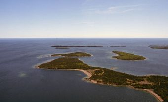
Though the island is fertile only in spots, farming has always been a major economic activity. Turkey production thrived after 1920 and by 1930, the island was one of the most important sheep-rearing areas in Ontario. Logging dates from the 1860s and commercial fishing for whitefish and trout was also an economic mainstay; however, both these industries have declined.
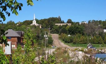
Since the 1920s, the island has become a popular outdoor recreation area, and tourism and agriculture are now the principal activities. Little Current, within the town of Northeastern Manitoulin and the Islands, and Gore Bay are the main populated centres. Little Current is linked to the mainland by road. The railway reached Little Current in 1913, but the line was abandoned in 1980. The swing bridge built for the railway remains for vehicle traffic. A ferry runs for much of the year from South Baymouth to Tobermory on the northern tip of the Bruce Peninsula.