Share on Facebook
 Share on X
 Share by Email
 Share on Google Classroom
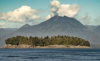
Revelstoke, British Columbia, incorporated as a city in 1899, population 7,547 (2016 census), 7,139 (2011 census). The city of Revelstoke is situated on the Columbia River between the Selkirk and Monashee mountains. It is on the Trans-Canada Highway at the western entrance to Rogers Pass and Mount Revelstoke and Glacier national parks. Revelstoke is located on the traditional territory of the Ktunaxa, Sinixt, Secwepemc and Okanagan peoples. (See also Interior Salish.)
Settlement and Development
Explorer David Thompson was the first European to travel past the site of Revelstoke in 1811. The area was eventually settled in the mid-1800s. By the 1870s it was known as “Big Eddy” and “Second Crossing” (of the Columbia River). The original townsite, laid out in 1884, was named Farwell after a surveyor. In 1886, the new Canadian Pacific Railway (CPR) station just to the west was named Revelstoke after Lord Revelstoke. Lord Revelstoke’s British bank had invested in the CPR. Mining and the railway spurred the community’s growth. In 1899, Revelstoke became the mountain divisional centre for the CPR, and for many years it was the western entrance to the old Big Bend Highway along the Columbia River through the Selkirk Mountains.
Economy
Today the CPR remains an important employer, along with forestry and tourism. Mining has contributed little to the economy since the closing of a nearby copper mine in 1996. The downtown has been revitalized by restoring many of its old brick buildings. The former post office and customs building (built 1926) houses the district’s museum. A railway museum acknowledges Revelstoke’s major transportation role. The city has a number of festivals including Timber Days (logging sports event) and LUNA Fest (visual and performing arts). Revelstoke Dam, one of the highest concrete dams in Canada, is located 5 km north.