Share on Facebook
 Share on X
 Share by Email
 Share on Google Classroom
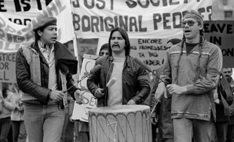
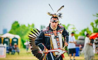
The names of many rivers and lakes in Canada have Indigenous origins. These bodies of water are named for Indigenous people, places, and aspects of Indigenous culture. Some of these lakes and rivers still bear the original name given to them by Indigenous people. Others have been renamed using an Indigenous word as a means of recognizing Indigenous history and working toward reconciliation. This list article explores the Indigenous names of five rivers and five lakes in Canada. (See also Longest Rivers in Canada and Largest Lakes in Canada.)

Indigenous Names of Rivers in Canada
1. Athabasca River
The Athabasca is Alberta’s second longest river and longest undammed river. It has been designated a Canadian Heritage River. The Athabasca flows northward for over 1,500 km from the Columbia Icefield in Jasper National Park and empties into Lake Athabasca. Its waters eventually find their way to the Arctic Ocean. The many tributaries of the Athabasca River Basin make up about nearly a quarter of Alberta’s land mass. ( See also Athabasca River – Interactive Map.)
Athabasca is a Woods Cree word meaning, “grass or reeds here and there.” (See also Cree Language.) The river afforded food, water, and a transportation and trade route for the Cree, Tsek’ehne (Sekani), Ktunaxa (Kootenay), Secwépemc (Shuswap), Salish, and Stoney nations. Hudson’s Bay Company trappers and traders relied on the Athabasca for their livelihoods. Today, the river brings life to the towns of Jasper, Hinton, Whitecourt, Athabasca, and Fort McMurray, where it has been an essential element in the development of the oil sands project.
2. South Nahanni River
The South Nahanni River is one of the continent’s most breathtakingly beautiful wild rivers. It flows from the granite peaks of the Selwyn Mountains, along the Yukon- Northwest Territories border, through the rugged Mackenzie Mountains, and finally feeds the Liard River. With power and majesty, the river splits itself at Mason’s Rock, then plunges 92 metres at Virginia Falls—just under twice the height of Niagara Falls.
Dene oral stories tell of the independent, mountain-dwelling Naha people. From them and the Athapaskan language comes the river’s name, which means “people of the west.” The South Nahanni River flows for about 320 km through the 30,000 km2 of the Nahanni National Park Reserve. In 1978, the original Nahanni National Park was designated a UNESCO World Heritage site. It is co-managed by the Dehcho First Nations who represent Métis, Dene, and other First Nations peoples whose traditional territories include the river and its surrounding area.
3. Assiniboine River
The river’s name derives from the Assiniboine people. Their traditional lands consisted of what is now southwestern Manitoba, southeastern Saskatchewan, and north central Montana and North Dakota. Assiniboine means “those who cook by placing hot stones in water.”
The Assiniboine River flows for 1,070 km through southwestern Saskatchewan. It welcomes the waters of the Whitesand and Lilian rivers, and then crosses into Manitoba, where it merges with the Red River at Winnipeg. Manitoba’s vast and fertile plains that allow farmers to produce wheat for millions are fed by the Assiniboine and its two major tributaries, the Qu’Appelle and Souris Rivers. Major cities that lie upon its banks and depend on its bounty include Portage la Prairie, Brandon, and Winnipeg.
4. Ottawa River
The Ottawa is Canada’s eighth largest river and has been designated a Canadian Heritage River. It runs for 1,271 km west from its origins in the Laurentian Mountains, then southeast along the Quebec- Ontario border to become the St. Lawrence River’s main tributary.
The Ottawa River was an important avenue of commerce for local Indigenous peoples. Its name is derived from the Odawa people, who used the river to trade. French explorers travelled the river forging trade and military alliances with the Algonquin people.

5. Cowichan River
The Cowichan begins its 47 km journey to the Pacific Ocean at Lake Cowichan and flows through the picturesque southwest of Vancouver Island. The upper portion of its watershed is a lush rainforest. It rushes southeast, tumbling over Skutz Falls, a number of rapids, and the sheer rock walls of Marie Canyon. The river meanders through flatlands in the shadow of hemlock and then, closer to the ocean, towering Douglas fir. It has been designated a Canadian Heritage River.
The river’s name derives from the Hul’q’umi’num word Quw’utsun, which means “warming your back.” (See also Coast Salish.) For millennia, the Cowichan people enjoyed the bounty of the river and the Cowichan River Valley. Much later, the river allowed Europeans to exploit the economic potential of the surrounding forests with logs flowing through its waters to be sold around the world.
Indigenous Names of Lakes in Canada
1. Lake Winnipeg
Fifty-four km north of Winnipeg lays the lake of the same name. It is fed by the Saskatchewan, Red, Dauphin, and Winnipeg rivers. It drains northward into the Nelson River and, eventually, into Hudson Bay. While shallow, Lake Winnipeg is Canada’s 6th largest freshwater lake—425 km long, over 100 km wide in spots, and covering 24,387 km2.
Within the lake’s mammoth watershed are portions of the territories of over 100 Indigenous nations. Winnipeg comes from the Cree phrase, win nipee, which means “muddy water.” Two portions of the lake’s eastern shoreline are part of the UNESCO World Heritage Site Pimachiowin Aki, which is an Anishinaabemowin word meaning “the land that gives life.

2. Lake Ontario
Ontario is derived from the Haudenosaunee word kanadario, which means “sparkling water.” Long before Europeans were shown the lake, it was important to several Woodland Indigenous nations that plied its waters. (See also Eastern Woodlands Indigenous Peoples in Canada.)
Lake Ontario is one of the Great Lakes, the 7th largest lake in Canada, and the 13th largest in the world. Its shoreline is 1,146 km long. Lake Ontario is principally fed from the east by the Niagara River and is augmented by several southward flowing rivers before surrendering its waters to the St. Lawrence River.
3. Mistassini Lake
Mistassini is Quebec’s largest lake. Its surface area is 2,335 km2. It is 160 km long and 19 km wide. It lies in the west-central Nord-du-Quebec region, east of James Bay.
At its outlet into Rivière de Rupert stands an imposing 3-m-high glacial rock which gave the lake its name. Mista assini is the Cree word for “great stone” or “great rock.” A 1948 archeological survey uncovered 121 ancient sites in the area that had been used by Indigenous people. This only confirmed Cree oral histories of their nations occupying the land and enjoying the lake’s bounty for thousands of years.
4. Nettilling Lake
Nettilling Lake is Nunavut’s largest lake. It is the world’s largest lake on an island. Its sparkling waters lie in the southern portion of Baffin Island and cover 5,542 km2. The lake is fed from the south by the Amadjuak River and from the north by the silty water of the Penny Ice Cap. It empties into the Koukdjuak River, then to the tundra of the enormous Foxe Basin. The lake is ice-locked most of every year.
The origin of Nettilling Lake’s name is uncertain. Some say it derives from the Inuktitut word netsilak, meaning “adult ringed seal.” Others argue that Nettilling is a word meaning the “place of many fish.” Regardless, Nettilling Lake was historically important to the Inuit, who drew fish and water from the lake. Unfortunately, a commercial fishery established on the lake that brought tourists to seek Arctic char had, by the 1960s, dangerously depleted the stock. Despite a number of initiatives, the lake has still not fully recovered.
5. Beothuk Lake
Beothuk Lake is in central Newfoundland. It drains northeast into the Exploits River and eventually into the Atlantic Ocean. It is over 64 km long and at one spot is nearly 6 km wide. It boasts abundant Arctic char, Brook trout, and ouananiche.
In the Beothuk language the word beothuk means “the people” or “true people.” The Beothuk lived in what became Newfoundland before Europeans arrived in the early 1500s. Permanent French and English settlements in the 1700s pushed the Beothuk off their traditional coastal territories. Their population consequently reduced significantly.
For decades, Beothuk Lake was called Red Indian Lake. In October 2021, after consultation with Indigenous leaders as part of efforts toward reconciliation, the Newfoundland and Labrador government announced that the lake would be renamed Beothuk Lake.