Share on Facebook
 Share on X
 Share by Email
 Share on Google Classroom
Cadastre is a technical term used in Europe for the registration of land in a given municipal area such as a city or a county. A “cadastral survey” is the measuring, marking and description of parcels of land sufficient for their correct entry into the public land register. It is also the marking on the ground of parcels in accordance with a description in the register.
In the latter instance, this could be either an original survey or a retracement when the position of the original boundary is not clear. Within provincial boundaries in Canada, land ownership and all fiscal matters pertaining to land are under provincial jurisdiction. The provinces set the rules and procedures for the cadastral surveys of their lands, including the licensing of surveyors. In Yukon, the Northwest Territories, Nunavut and federal lands in the provinces, such as Indian reserves and national parks, the federal government has this responsibility.
Legal Description
An essential part of any cadastral survey is the legal description, which must give the size, shape and location of the parcel being surveyed. It may be in writing, in writing with a plan, or entirely on a registered plan. The traditional written description is by “metes and bounds.” By this method, the parcel’s boundary lines are described in succession by stating the direction and length of each line, and by describing the survey markers or natural features that identify the boundary lines on the ground.
A registered plan is used when a parcel is being subdivided and a number of lots are being established simultaneously. Such a plan must show the dimensions, boundary line bearings, areas and survey markers of each lot, and each lot must be numbered or otherwise identified. It can then be identified in a deed or other document by plan and lot number and the office where the plan is registered.
Township Surveys
In many parts of Canada, the original subdivision of Crown land was done by township surveys, essential to orderly settlement. Different sizes of townships have been used (e.g., Quebec’s irregularly shaped cantons and Ontario’s concession townships), but all were designed to provide rectangular farm lots within a defined rural community.
The survey of a township was essentially a subdivision survey, because the plan of the township was registered and the lots (sometimes called sections) were numbered. The description of a whole lot for legal purposes is complete in the identification of the township and the lot within the township.
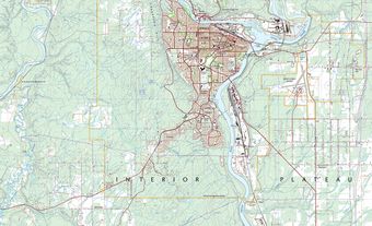
If only part of a lot is in question, a metes and bounds description, or some other method such as fractional parts, must be used (e.g., “the north half of Lot 24, Concession II, in the Township of North Burgess”). As cities and towns extend into rural areas, it is common to find a township farm lot being subdivided into a number of city lots.