Share on Facebook
 Share on X
 Share by Email
 Share on Google Classroom
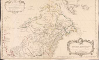
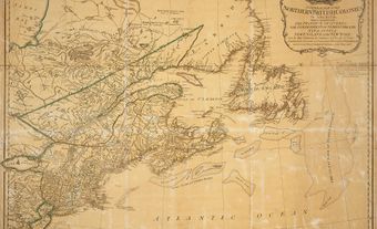
Cartography is the art, science and technology of making maps, plans, charts and globes representing Earth or any celestial body at any scale. Cartographic documents have been used as vehicles of communication by different cultures for many millennia; the earliest map to survive, drawn about 2300 BCE on a clay tablet, was found in the Middle East. In Canada, Indigenous people drew maps on the ground and in the snow, and sometimes committed them to media such as animal skins or bark. The maps of the 16th century were rough and often conjectural; maps of the French period became more accurate in the better-known areas; and after 1800, with the widespread use of the sextant and advanced astronomical techniques for determining longitude (for example, using the marine chronometer), the major gaps in the map of Canada were filled. During the 20th century, mapping skills were greatly refined in Canada.
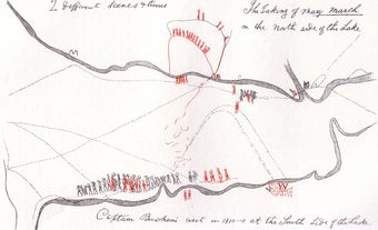
This article provides background on the history of cartography in Canada. For more detailed information please see Cartography in Canada: Indigenous Mapmaking; Cartography in Canada: 1500s; Cartography in Canada: 1600–1763; Cartography in Canada: 1763–Second World War; Cartography in Canada: Mapping Since the Second World War; National Topographic System; Cadastral Surveying.

Historical Background
Centuries before the Common Era, Greek philosophers and mathematicians such as Pythagoras and Aristotle advanced the concept that Earth was a sphere, and Eratosthenes (c. 276–196 BCE) made a reasonable calculation of Earth’s circumference.
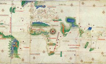
In the 2nd century CE, Claudius Ptolemy compiled and systematized the geographical knowledge of the day and encouraged the scientific study of geography. He suggested, for example, that maps be drawn strictly to scale (at that time not a common practice), that general world maps should be supplemented with a series of regional maps drawn at appropriate scales, and that maps should be drawn with co-ordinates.
Ptolemy’s works were ignored until early in the 15th century, when an avid interest in the classical period had been revived by the Renaissance. His writings, translated from the Byzantine Greek, were copied in manuscript and later published. In a 1507–08 edition of Ptolemy’s Geographia, a map by Johannes Ruysch showing a portion of eastern Canada appeared. During the next century the Ptolemaic atlases became a major instrument of the diffusion of geographical knowledge of Canada.
In the following centuries, the mapping of Canada evolved with the advance of cartographic techniques around the world and with continued exploration along the coasts and into the heart of the country. The development of instruments and techniques also changed the nature of the data gathered and the maps produced.