Share on Facebook
 Share on X
 Share by Email
 Share on Google Classroom
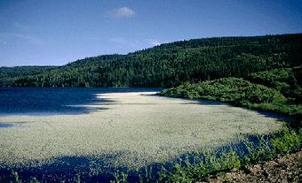
Cape Scott Provincial Park (established 1973, 50 km2), on the northwest tip of VANCOUVER I, BC, includes 64 km of coast with 23 km of sandy beaches interspersed by rocky headlands. The land rises inland to Mount St Patrick (415 m), and in it lies a 44 ha body of freshwater, Eric Lake. The park has a rigorous climate with storms and heavy rainfalls; annual precipitation is 375-500 cm. Forests include cedar, pine, hemlock and fir, with a dense undergrowth of salal, salmonberry, huckleberry and fern. Animals include deer, elk, bears, otters, cougars and wolves, with seals, sea lions and gulls along the shore, and migrating Canada geese at Hansen Lagoon. Coastal Indians first occupied and exploited the area.
Cape Scott was named in 1786 after David Scott, a Bombay merchant who backed a trading voyage along the coast under Captains Guise and Lowrie. In 1897 and 1910 Danish pioneers made unsuccessful attempts to settle, leaving only place-names and abandoned buildings as evidence. Trails provide the only access, the trailhead being reached by public highway and logging road from Port Hardy, some 60 km east. There are few facilities except primitive, often muddy trails that run from the trailhead to Cape Scott, a distance of 27 km.