Article
Acadian Historical Village
The Acadian Historical Village (Village historique acadien) is an ambitious living history site located on the Rivière-du-Nord near Caraquet, NB, in the heart of the Acadian Peninsula.

Enter your search term
Signing up enhances your TCE experience with the ability to save items to your personal reading list, and access the interactive map.
Create AccountArticle
The Acadian Historical Village (Village historique acadien) is an ambitious living history site located on the Rivière-du-Nord near Caraquet, NB, in the heart of the Acadian Peninsula.
"https://www.thecanadianencyclopedia.ca/images/tce_placeholder.jpg?v=e9dca980c9bdb3aa11e832e7ea94f5d9" // resources/views/front/categories/view.blade.phphttps://www.thecanadianencyclopedia.ca/images/tce_placeholder.jpg?v=e9dca980c9bdb3aa11e832e7ea94f5d9

Article
The cliff is on a big rock of white crystalline granite, which contrasts with the red paintings although mineral traces, lichens and graffiti have damaged them in some places.
"https://d3d0lqu00lnqvz.cloudfront.net/media/media/71281b2f-b349-43f2-aa64-81e3ee6e2e28.jpg" // resources/views/front/categories/view.blade.phphttps://d3d0lqu00lnqvz.cloudfront.net/media/media/71281b2f-b349-43f2-aa64-81e3ee6e2e28.jpg

Article
The site is important because it confirms that Centrosaurus was a herding dinosaur, and documents that the herds were larger than previously thought, numbering well into the thousands.
"https://d3d0lqu00lnqvz.cloudfront.net/media/media/02a642a0-0d77-4886-9c75-55a389c9b77a.jpg" // resources/views/front/categories/view.blade.phphttps://d3d0lqu00lnqvz.cloudfront.net/media/media/02a642a0-0d77-4886-9c75-55a389c9b77a.jpg

Article
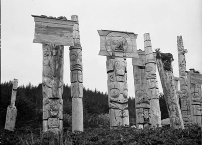
The overgrowth of lush vegetation has been cleared away from the remains of Ninstints's longhouses and totem poles, which pay silent homage to their creators.
"https://d3d0lqu00lnqvz.cloudfront.net/media/media/1c61ad08-f404-4f01-83ee-d9b43e4b833b.jpg" // resources/views/front/categories/view.blade.phphttps://d3d0lqu00lnqvz.cloudfront.net/media/media/1c61ad08-f404-4f01-83ee-d9b43e4b833b.jpg

Article
Argentia, NL, Unincorporated Place. Argentia is located on the west coast of the Avalon Peninsula of Newfoundland.
"https://www.thecanadianencyclopedia.ca/images/tce_placeholder.jpg?v=e9dca980c9bdb3aa11e832e7ea94f5d9" // resources/views/front/categories/view.blade.phphttps://www.thecanadianencyclopedia.ca/images/tce_placeholder.jpg?v=e9dca980c9bdb3aa11e832e7ea94f5d9

Article
The Bache Peninsula archaeological sites are located on Ellesmere Island in Nunavut. The sites were occupied about 4200 years ago by hunting bands believed to have originated from northeast Asia and Alaska.
"https://www.thecanadianencyclopedia.ca/images/tce_placeholder.jpg?v=e9dca980c9bdb3aa11e832e7ea94f5d9" // resources/views/front/categories/view.blade.phphttps://www.thecanadianencyclopedia.ca/images/tce_placeholder.jpg?v=e9dca980c9bdb3aa11e832e7ea94f5d9

Article
Sheriff Alexander C. Macdonell, Selkirk's agent, struggled for years at considerable expense to the earl to make a success of the venture, but found the swampy land and the difficulty of sheep farming to be serious obstacles.
"https://d3d0lqu00lnqvz.cloudfront.net/media/media/0c582e2e-b609-41c2-b9dc-50071198f9c4.jpg" // resources/views/front/categories/view.blade.phphttps://d3d0lqu00lnqvz.cloudfront.net/media/media/0c582e2e-b609-41c2-b9dc-50071198f9c4.jpg

Article
Balmoral Grist Mill in Balmoral Mills, NS, was built in about 1874 by Alexander MacKay. The mill is located on Matheson's Brook and was once just one of 5 mills on the brook. It was used to grind local stocks of wheat, oats, barley, rye and buckwheat to produce flour and oatmeal.
"https://www.thecanadianencyclopedia.ca/images/tce_placeholder.jpg?v=e9dca980c9bdb3aa11e832e7ea94f5d9" // resources/views/front/categories/view.blade.phphttps://www.thecanadianencyclopedia.ca/images/tce_placeholder.jpg?v=e9dca980c9bdb3aa11e832e7ea94f5d9

Article
The Balzac Archaeological site (Borden No. EhPm-34) is a late prehistoric camp and bison-processing site that was occupied from ca 2000 Before Present (BP) to 1850 AD.
"https://d3d0lqu00lnqvz.cloudfront.net/media/media/1a9e14d0-3eda-41ab-9f64-1603d5cb85e5.jpg" // resources/views/front/categories/view.blade.phphttps://d3d0lqu00lnqvz.cloudfront.net/media/media/1a9e14d0-3eda-41ab-9f64-1603d5cb85e5.jpg

Article
Bar U Ranch, officially known as the North West Cattle Company, was founded in 1882 in the southern foothills of the Rocky Mountains, in what would become the province of Alberta. Nicknamed “Bar U” after the shape of its cattle brand, the ranch was one of the largest of the ranches dominating the prairies in the late 1800s. In the early 1990s, Parks Canada bought Bar U with the aim of turning it into a public place commemorating Canada’s ranching history. The Bar U Ranch National Historic Site opened in July 1995.
"https://d3d0lqu00lnqvz.cloudfront.net/media/media/c1768818-c5e1-42ce-94fe-95920c9b2d13.jpg" // resources/views/front/categories/view.blade.phphttps://d3d0lqu00lnqvz.cloudfront.net/media/media/c1768818-c5e1-42ce-94fe-95920c9b2d13.jpg

Article
By November 1813, the Americans were in control of the Detroit River frontier while the British had established small outposts at Port Talbot and the village of Delaware.
"https://d3d0lqu00lnqvz.cloudfront.net/media/media/eb215d4d-3eb9-46ac-aa02-a021a8b1d9d8.jpg" // resources/views/front/categories/view.blade.phphttps://d3d0lqu00lnqvz.cloudfront.net/media/media/eb215d4d-3eb9-46ac-aa02-a021a8b1d9d8.jpg

Article
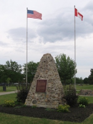
In 1976, the cairn was moved to the newly created Battle of Beaverdams Park in Thorold. Also moved to the park was a stone monument, erected in 1874, marking the grave of 16 American soldiers found during the construction of the third Welland Canal.
"https://d3d0lqu00lnqvz.cloudfront.net/media/media/ed860320-50c1-449e-884d-bd4968480689.jpg" // resources/views/front/categories/view.blade.phphttps://d3d0lqu00lnqvz.cloudfront.net/media/media/ed860320-50c1-449e-884d-bd4968480689.jpg

Article
The battleground was designated as a national historic site in 1920, but is owned and administered by the Niagara Parks Commission. Called Chippawa Battlefield Park, it lies on the west side of the Niagara River Parkway.
"https://d3d0lqu00lnqvz.cloudfront.net/media/media/0a912643-d9dd-44f2-bc07-3664e3cee776.jpg" // resources/views/front/categories/view.blade.phphttps://d3d0lqu00lnqvz.cloudfront.net/media/media/0a912643-d9dd-44f2-bc07-3664e3cee776.jpg

Article
The Historic Sites and Monuments Board of Canada designated the battleground at Cook's Mills as a national historic site in 1921. Two years later, a plaque summarizing the story of the skirmish was mounted on a stone cairn on the field of action.
"https://www.thecanadianencyclopedia.ca/images/tce_placeholder.jpg?v=e9dca980c9bdb3aa11e832e7ea94f5d9" // resources/views/front/categories/view.blade.phphttps://www.thecanadianencyclopedia.ca/images/tce_placeholder.jpg?v=e9dca980c9bdb3aa11e832e7ea94f5d9

Article
Before a national program of designating historic places was developed, the Government of Canada erected a monument commemorating the Battle of Crysler's Farm on the battlefield in 1895.
"https://d3d0lqu00lnqvz.cloudfront.net/media/media/7b2eb773-c251-420c-a574-4ca7212f66db.jpg" // resources/views/front/categories/view.blade.phphttps://d3d0lqu00lnqvz.cloudfront.net/media/media/7b2eb773-c251-420c-a574-4ca7212f66db.jpg
