Share on Facebook
 Share on X
 Share by Email
 Share on Google Classroom

Early Life
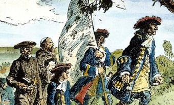
Thompson attended the Grey Coat Hospital in London, a school for the poor and orphaned. He was recruited by the Hudson’s Bay Company when he was 14 and in 1784 he sailed to what is now Churchill, Manitoba, to work as an apprentice in the fur-trading business.
In that northern wilderness Thompson had a remarkable experience that changed him forever. In his journal, he describes how the devil came into his room and started playing checkers with him. “I was sitting at a small table with the chequer board before me, when the devil sat down opposite to me, his features and colour were those of a Spaniard, he had two short black horns on his forehead which pointed forwards; his head and body down to his waist (I saw no more) was covered with glossy black curling hair…” They played and the devil lost every game. “He got up or rather disappeared. My eyes were open it was broad daylight, I looked around, all was silence and solitude, was it a dream or was it reality? I could not decide.”
Whichever it was, the experience changed him. He remained a devout Christian throughout his life.
Travels and Encounter with Indigenous Peoples
When he was 17, Thompson left Churchill to walk and paddle across the prairies to the Alberta foothills where thousands of Piikani people were camped. He spent a magical winter in the tent of an 80-year-old elder named Saukamappee, who told him stories about the Plains Indigenous peoples as the fire burned to keep them warm. Saukamappee described the Piikani’s encounter with smallpox, which killed hundreds. The Piikani had planned a nighttime raid on an enemy band, but arrived to find them all dead. It turned out to be smallpox, and when they took the possessions of the dead, they too became infected. “We had no belief that one man could give it to another, any more than a wounded man could give his wound to another,” Saukamappee said. “We shall never be again the same people.”
Thompson learned to speak several Indigenous languages and was an acute and sympathetic observer at a time when most Europeans still saw Indigenous people as savages.
Map-Making and Exploration
Thompson learned astronomy and mathematics and spent so much time examining the sun and stars that he lost his sight in one eye. He broke his leg and it healed badly and he had a limp for the rest of his life. Yet this one-eyed, limping man mapped more territory than any other European. He surveyed the territory west of Lake Superior and the 49th parallel, which eventually became the dividing line between Canada and the United States. He mapped the north and paddled to the west coast. He mapped not only the land but also the cultural and religious practices of its inhabitants. His journals (which numbered hundreds of pages) and his maps provided the most complete record of a territory that was more than 3.9 million square km and contained dozens of different First Nations bands.
In 1799, Thompson married a Métis woman named Charlotte Small. He was 29; she was 13. Their marriage lasted 58 years. They had 13 children, 5 of them while he was still exploring. Thompson often took those children and his wife on his trips, venturing into unknown, sometimes hostile territory. At the Hudson’s Bay Company, he was valued as a fur trader, but Thompson wanted to explore rather than trade. He left the HBC and joined the rival North West Company where he spent the next 15 years exploring. In all, he spent 27 years mapping the west. “The age of guessing is passed away,” he wrote. Thompson predicted the changes that would come to the west, that it would become farmland and Indigenous peoples would be pushed from their land. As the one who mapped it, he was aware that he was contributing to that future.
Later Years
Thompson’s later years were marred by tragedy. He moved to Montréal in 1812 so his children could get a formal education. He had saved some money from his years as a trader but lost most of it in bad investments in Montréal. Personal tragedy followed his financial setbacks. His five-year-old son John died, and then his seven-year-old daughter. His eldest son rebelled and left home and Thompson never saw him again.
He took on odd jobs to pay the rent and kept working on the maps he had drawn of the west. But he couldn’t find a publisher for the maps. In the end he sold them to Arrowsmith, a London publisher, who paid him 150 pounds, an absurdly low sum for his life’s work. Then Arrowsmith didn’t publish them under Thompson’s name, which would have earned him some measure of fame, at least as a map-maker. Instead they used his maps to correct their own and didn’t credit Thompson.
He took on the job of surveying the vast estate of fellow explorer Alexander Mackenzie, who wasn’t as ambitious or accomplished as Thompson, but was a much better manager of money. When that job ended, Thompson had trouble finding work and had to pawn his surveying tools and his winter coat.
He moved in with his daughter and son-in-law and spent his time working on his journals, trying to make them into something publishable. His one good eye began to fail him and he never completed the manuscript. One of the greatest explorers in history died in poverty and obscurity in 1857 and was buried in Montréal. His wife Charlotte was inconsolable, and she died less than three months later.