Share on Facebook
 Share on X
 Share by Email
 Share on Google Classroom
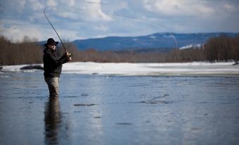
Attawapiskat River, 748 km long, formed by the confluence of the Pineimuta, Trading and Otoskwin rivers at Attawapiskat Lake, in northeastern Ontario, flows east, jogs north and runs east to the flatland by James Bay. Its drainage area is 50 200 km2 and its mean discharge 626 m3/s.
Attawapiskat River, 748 km long, formed by the confluence of the Pineimuta, Trading and Otoskwin rivers at Attawapiskat Lake, in northeastern Ontario, flows east, jogs north and runs east to the flatland by James Bay. Its drainage area is 50 200 km2 and its mean discharge 626 m3/s. Its mouth, mired in bog and marsh, is a migratory stopover for great numbers of ducks and geese. The whole course is largely uninhabited except for a few trading posts and the small Cree settlement of Attawapiskat at the river mouth. The name, from the Algonquian atawabiskat meaning "rock bottom," refers to its limestone bed, once the bottom of an ancient sea.