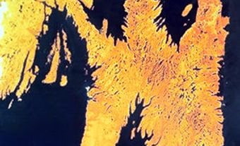
Cape Bonavista, elevation 15-30 m, is the bare, rocky extremity of the Bonavista Peninsula, north of the town of Bonavista in eastern Newfoundland. Traditionally thought of as the landfall (1497) of John Cabot (who is said to have named it), from 1713 to 1783 it was the southern terminus of the French Shore. One of Newfoundland's earliest lighthouses was built here in 1843 and declared a provincial historic site in 1978 (see also Cape Bonavista Lighthouse). It was subsequently restored and opened as a museum.
-
- MLA 8TH EDITION
- Pitt, Robert D.. "Cape Bonavista". The Canadian Encyclopedia, 03 October 2014, Historica Canada. www.thecanadianencyclopedia.ca/en/article/cape-bonavista. Accessed 26 July 2024.
- Copy
-
- APA 6TH EDITION
- Pitt, R. (2014). Cape Bonavista. In The Canadian Encyclopedia. Retrieved from https://www.thecanadianencyclopedia.ca/en/article/cape-bonavista
- Copy
-
- CHICAGO 17TH EDITION
- Pitt, Robert D.. "Cape Bonavista." The Canadian Encyclopedia. Historica Canada. Article published November 11, 2008; Last Edited October 03, 2014.
- Copy
-
- TURABIAN 8TH EDITION
- The Canadian Encyclopedia, s.v. "Cape Bonavista," by Robert D. Pitt, Accessed July 26, 2024, https://www.thecanadianencyclopedia.ca/en/article/cape-bonavista
- Copy
Thank you for your submission
Our team will be reviewing your submission
and get back to you with any further questions.
Thanks for contributing to The Canadian Encyclopedia.
CloseArticle
Cape Bonavista
Article by Robert D. Pitt
Published Online November 11, 2008
Last Edited October 3, 2014

 Share on Facebook
 Share on X
 Share by Email
 Share on Google Classroom

