Share on Facebook
 Share on X
 Share by Email
 Share on Google Classroom
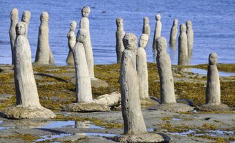
Cape St Mary forms the southern boundary of St Mary's Bay in an area of Nova Scotia's northwestern coast known as the French Shore. Fishing is the principal activity in this region; the cape was once the site of the International Tuna Cup matches.
Cape St Mary forms the southern boundary of St Mary's Bay in an area of Nova Scotia's northwestern coast known as the French Shore. Fishing is the principal activity in this region; the cape was once the site of the International Tuna Cup matches. Below the cape lies Mavillette Beach, a long stretch of sand that has been developed into a provincial park. The marsh behind the dunes is ideal for bird watching.