Share on Facebook
 Share on X
 Share by Email
 Share on Google Classroom
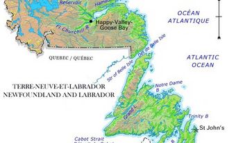
Clarenville, NL, incorporated as a town in 1951, population 6036 (2011c), 5274 (2006c). The Town of Clarenville is situated in a long, picturesque arm facing RANDOM ISLAND on the west side of TRINITY BAY. Clarenville was an amalgamation (in the early 1890s) of 5 small logging and sawmilling communities, which had been settled in the mid-1800s. The origin of the town's name is unknown, but one theory holds that it was intended to be Clarenceville, after the Duke of Clarence, a grandson of Queen Victoria, but somehow the name evolved to Clarenville by 1901. In 1994 the lumbering town of Shoal Harbour (incorporated in 1972) was merged with Clarenville. Until 1996 the town was known as Clarenville-Shoal Harbour.
Located at the base of the Bonavista peninsula on the original route of the Newfoundland Railway, Clarenville was selected as one of five major terminals between St John's and Port aux Basques in 1891, and later became the terminus of the Bonavista branch line, which was constructed in 1909-11. The town became a TELECOMMUNICATIONS centre when the first transatlantic submarine telephone cables (TAT-1 and TAT-2) between North America and Europe landed here in 1956 and 1958, respectively. Shipbuilding (beginning in 1942), asphalt and creosote manufacturing, agriculture, and tourism also have all been significant aspects of its economy.
Today only a small shipbuilding industry remains and Clarenville has become mainly a service centre for the surrounding area. The two major industries in the region are North Atlantic Refining at COME BY CHANCE and a fabrication plant at Bull Arm, which builds and services components for the off-shore oil industry.