Share on Facebook
 Share on X
 Share by Email
 Share on Google Classroom
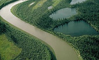
The Coppermine River, 845 km long, rises in the Barren Lands of the Northwest Territories in Lac de Gras and flows northwest through Point Lake to Coronation Gulf on the Arctic Ocean. The majority of its course lies in Nunavut.
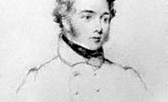
The Coppermine River, 845 km long, rises in the Barren Lands of the Northwest Territories in Lac de Gras and flows northwest through Point Lake to Coronation Gulf on the Arctic Ocean. The majority of its course lies in Nunavut. At BLOODY FALLS, 15 km south of the ocean, a series of rapids tumble through a narrow gorge of volcanic rock. The valley floor lies some 150-200 m below the surrounding plateau. Samuel HEARNE named the falls in 1771 after witnessing the killing of a party of Inuit by his Chipewyan guides. Sir John FRANKLIN and George BACK travelled the river some 50 years later. The river was also named by Hearne for the copper outcroppings he noticed along its banks. The hamlet of KUGLUKTUK lies at its mouth.