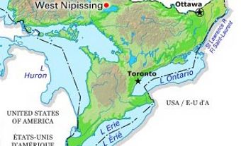
Haldimand County, Ont, incorporated as a city in 2001, population 44 876 (2011c), 45 212 (2006c). The City of Haldimand County is situated on the north shore of LAKE ERIE along the GRAND RIVER, 20 km south of HAMILTON. The city is composed of 6 urban areas: Caledonia, Cayuga, DUNNVILLE, Hagersville, Jarvis and Townsend. Haldimand County was named in 1783 after Sir Frederick HALDIMAND, governor of Québec, who had granted land along the Grand River to the Six Nations of the IROQUOIS in recognition of their loyalty and as compensation for lands lost during the AMERICAN REVOLUTION.
Led by Joseph BRANT, the Six Nations settled the tract in 1784. Brant also encouraged LOYALISTS to settle in the tract and they leased or bought up most of the land. In 1841 the federal government purchased what remained of the original tract and an INDIAN RESERVE was established, which lies west of present day Haldimand County. During the 1830s, the Grand River was canalized by the Grand River Navigation Company to encourage trade. Dams were also built and their water power encouraged industry in Dunnville and Caledonia.
Haldimand County was first incorporated in 1850 and eventually included the townships of North Cayuga, South Cayuga, Dunn, Moulton, Sherbrooke, Canborough, Rainham, Walpole, Oneida and Seneca. In 1974 the county was amalgamated with Norfolk County to become the Regional Municipality of Haldimand-Norfolk, and the town of Haldimand was formed from the town of Caledonia, the townships of Oneida, Seneca, North Cayuga, South Cayuga, Rainham and Walpole (part), and the villages of Cayuga and Hagersville in the county of Haldimand. In 2001, the regional municipality was abolished, and the local municipalities of Dunnville, Haldimand and part of NANTICOKE were amalgamated into a single-tier authority. Although a city, it calls itself after its historic name Haldimand County. The administrative offices are in Cayuga, the original county seat.
The area's undulating terrain becomes level along the river valleys and is primarily agricultural. There are summer cottages along Lake Erie, former gypsum mines (although one is still active near Hagersville) and natural gas wells. In the 1970s the Ontario government supported the establishment of an extensive heavy industrial site adjacent to a new port on Lake Erie. Coal and iron ore are the principal raw materials brought in for a power generating station and a Stelco steel plant. There is also a petroleum refinery near the hamlet of Nanticoke. A number of other engineering and chemical firms have located here; but in an era since then of deindustrialization, the industrial site and nearby new communities have been seriously undersubscribed.

 Share on Facebook
 Share on X
 Share by Email
 Share on Google Classroom


