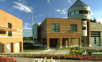
Burns Lake, BC, incorporated as a village in 1923, population 2029 (2011c), 2107 (2006c). The Village of Burns Lake is located on Highway 16 in the geographical centre of British Columbia on the Nechako Plateau, 226 km west of Prince George. Situated on the northwest end of Burns Lake (a widening of the Endako River), tourism is the village's main industry but it also serves as the local trading and service centre for agriculture and forest industries in the region known locally as the Lakes District. The area was first settled late in the 19th century during construction of the Overland Telegraph line intended to link Europe to the United States by way of Siberia. The lake and thus the village are named after Michael Byrnes, a surveyor for the Collins Telegraph Co who passed through in 1866.
There was little development until after construction of the Grand Trunk Pacific Railway, now the Canadian National Railway, between Jasper and Prince Rupert in 1914. Four major mines, producing molybdenum, copper, gold and silver, were opened in the region in the 1960s and two of these are still in production. Forestry became important after two large sawmills were built nearby in the late 1960s and early 1970s. In 2012, one of these mills, Babine Lake, was destroyed in an explosion and fire, and two employees were killed. Wood products manufacturing provides additional employment. Cattle ranching is also important in the district. Two First Nations bands have reserves that form part of Burns Lake.

 Share on Facebook
 Share on X
 Share by Email
 Share on Google Classroom

