Share on Facebook
 Share on X
 Share by Email
 Share on Google Classroom
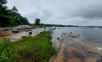
Lake Claire 1437 km2, elevation 213 km, max length 63 km, located in northeastern Alberta in the southeast corner of Wood Buffalo National Park, is an isolated western extension of Lake Athabasca and the largest lake entirely within Alberta.
Lake Claire 1437 km2, elevation 213 km, max length 63 km, located in northeastern Alberta in the southeast corner of Wood Buffalo National Park, is an isolated western extension of Lake Athabasca and the largest lake entirely within Alberta. Situated west of Fort Chipewyan (established 1788), it is fed by the Peace, Birch and McIvor rivers and drains eastward via Mamawi Lake into Lake Athabasca. Originally one of the deepest lakes in the Athabasca Delta region, it was named Clear Water Lake by Alexander Mackenzie (1792), and its clarity was remarked upon by David Thompson (map of 1814). Over the years it has become shallow through silt accumulation, but still has a commercially profitable goldeye fishery.