Share on Facebook
 Share on X
 Share by Email
 Share on Google Classroom
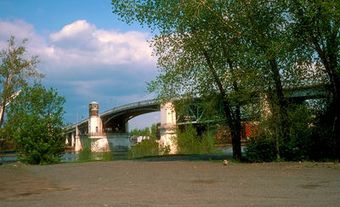
Listuguj, Quebec, is the common name for both a reserve and a Mi'kmaq First Nation. Listuguj is located on the Gaspé Peninsula at the mouth of Restigouche River. A bridge links it to Campbellton, New Brunswick. As of 2014, the Listuguj First Nation has 4,058 members, with 2,108 members living on the Listuguj reserve. The community was also previously known as Restigouche.
History
The Gaspé Peninsula and present-day northeastern New Brunswick have been inhabited by the Mi'kmaq since time immemorial.
In the 1750s, the Acadians began to settle the area, and on 8 July 1760, Listuguj was the site of the last battle between the French and British during the Seven Years' War (see Battle of Restigouche). The French lost three ships during that battle to the superior military tactics of the British. Now a national historic site, Parks Canada has developed an interpretation centre around the French ship Le Machault, which sank during the battle.
A mission dedicated to St Anne was built in 1745 and was served by the Capuchin order. One member, Father Pacifique (Henri Buisson d'Valigny, 1863-1943), produced a dictionary of the Mi'kmaq language.
Present Day
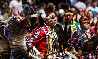
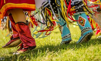
Today, Listuguj is home to an Arts and Culture Centre that features collections of baskets, quillwork, regalia, canoes, and authentic Mi'kmaq artifacts ranging from 500 to 3,000 years old. The community also hosts various cultural programs that promote and celebrate Mi’kmaq art, culture and language.