Share on Facebook
 Share on X
 Share by Email
 Share on Google Classroom
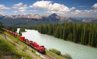
The Red Deer River (740 km, mean annual flow rate 62 m3/s), is glacier-fed by streams from Mount Drummond and Cyclone Mountain in the Rockies of Banff National Park in Alberta. It flows east then south to join the South Saskatchewan River just inside Saskatchewan. Its 44 500 km2 basin includes mountains, foothills and semiarid prairies; recognized white-water courses occur on its wilder upper reaches. On its lower portion, 300 km are lined by famous scenic Badlands containing dinosaur fossils, examples of which may be seen in the Royal Tyrrell Museum of Palaeontology (Drumheller, Alta) and Dinosaur Provincial Park, a United Nations World Heritage Site. The city of Red Deer is a major industrial (petrochemicals) user of water, along with irrigation and water-diversion schemes.
-
- MLA 8TH EDITION
- Campbell, Ian A.. "Red Deer River". The Canadian Encyclopedia, 22 June 2015, Historica Canada. www.thecanadianencyclopedia.ca/en/article/red-deer-river. Accessed 26 April 2024.
- Copy
-
- APA 6TH EDITION
- Campbell, I. (2015). Red Deer River. In The Canadian Encyclopedia. Retrieved from https://www.thecanadianencyclopedia.ca/en/article/red-deer-river
- Copy
-
- CHICAGO 17TH EDITION
- Campbell, Ian A.. "Red Deer River." The Canadian Encyclopedia. Historica Canada. Article published February 07, 2006; Last Edited June 22, 2015.
- Copy
-
- TURABIAN 8TH EDITION
- The Canadian Encyclopedia, s.v. "Red Deer River," by Ian A. Campbell, Accessed April 26, 2024, https://www.thecanadianencyclopedia.ca/en/article/red-deer-river
- Copy
Thank you for your submission
Our team will be reviewing your submission
and get back to you with any further questions.
Thanks for contributing to The Canadian Encyclopedia.
CloseArticle
Red Deer River
Article by Ian A. Campbell
Published Online February 7, 2006
Last Edited June 22, 2015
The Red Deer River (740 km, mean annual flow rate 62 m3/s), is glacier-fed by streams from Mount Drummond and Cyclone Mountain in the Rockies of Banff National Park in Alberta. It flows east then south to join the South SASKATCHEWAN RIVER just inside Saskatchewan.