Share on Facebook
 Share on X
 Share by Email
 Share on Google Classroom
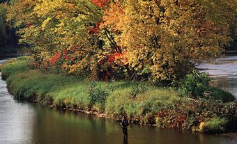
The Soper River winds southwards 108 km through the tundra-covered hills of southern Baffin Island before emptying into Soper Lake, a brackish water body, and then directly into Hudson Strait near the community of Kimmirut, Nunavut. The entire 2500 km2 drainage basin of the Soper including its 2 major tributaries, the Livingstone (86 km) and the Joy (54 km), were designated as a Canadian Heritage River in 1992.
The Soper, River Valley is sheltered from harsh winds and supports a "forest" of willows that grow up to 3.6 m high and a lush profusion of Arctic wildflowers. Game (caribou, ptarmigan and arctic hare) and fish (arctic char in the river and cod in Soper Lake) are plentiful. The Inuit have used the river as a vital source of food and travel for thousands of years. Named Kuujuaq, or "great river," in Inuktitut, it gets its English name from northern biologist J. Dewey Soper.
Canoeing, kayaking and rafting are popular recreational activities, as well as hiking and snowmobiling on the Itijjagiaq Trail, which connects Kimmirut to the capital of Nunavut, Iqaluit. The Itijjagiaq Trail and most of the Soper River drainage basin are within Katannilik Territorial Park Reserve.