Share on Facebook
 Share on X
 Share by Email
 Share on Google Classroom
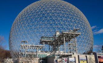
The Hochelaga Archipelago, also known as the Montreal Islands, is a cluster of islands at the confluence of the Ottawa and St. Lawrence rivers in southwestern Quebec. It is estimated that the archipelago comprises about 300 islands and islets, of which the Island of Montreal is the largest. Like the Island of Montreal, the other three largest islands — Île Jésus (most of the City of Laval), Île Bizard and Île Perrot — are inhabited, while most of the smallest ones are not. Several of the islands that comprise the archipelago are protected by the Nature Conservancy of Canada. Though not originally part of the island chain, Île-Notre-Dame is a man-made island within the archipelago, and today is home to Montreal’s Parc Jean-Drapeau.
History
Roughly 11,500 years ago, the only islands in the area now known as Greater Montreal were the tops of the Monteregian Hills. With elevations ranging from 130 m to 1,100 m, these dwarf mountains, such as Montreal’s Mount Royal, Mont Rougemont, Mont Saint-Hilaire or the Oka Hills, were relatively isolated within the receding Champlain Sea. About 8,000 years ago, the two largest islands of the archipelago, the Island of Montreal and Île Jésus (often thought of locally as “Laval”), began to take their modern forms. The number of islands that compose the archipelago has changed over time as water levels from the last ice age receded.
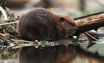
Indigenous habitation of the area is generally thought to extend back at least 5,000 years. Human remains, as well as evidence of Indigenous communities — in particular those of the St. Lawrence Iroquoians — have been found in various locations across the archipelago, including The Island of Montreal. Indeed, the word “Hochelaga” is a French corruption of an Indigenous word. It was originally thought to refer to the village visited by Jacques Cartier in 1535. Hochelaga is either a corruption of the Iroquoian words osekare, meaning “beaver path” or osheaga, meaning “big rapids.” The latter is possibly a reference to the Lachine Rapids which impeded Cartier’s voyage farther upriver.
Description
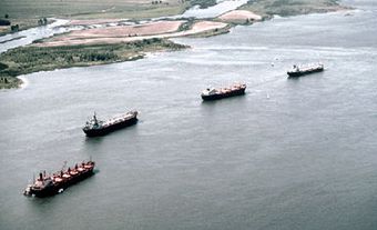
The islands that constitute the archipelago stretch from where the Ottawa River meets the Lake of Two Mountains to the collection of islands around Île Ste-Thérèse off the eastern tip of the Island of Montreal. The St. Lawrence River runs down from this point along the eastern edge of the Island of Montreal and passes over several narrows and rapids before pooling in Lac St-Louis. From there it continues towards the Thousand Islands and the Great Lakes beyond. Lac St-Louis and the Lake of Two Mountains are the two lakes in which the waters of the Ottawa and St. Lawrence Rivers meet. The Island of Montreal and Île Jésus are separated from each other by the Rivière des Prairies, while Île Jésus is separated from the mainland of Quebec by the Rivière des Milles Îles (“the river of a thousand islands”). Both of these smaller rivers contain many of the smallest islands of the Hochelaga Archipelago.
The archipelago has two very large islands: The Island of Montreal is about 483 km2 and houses approximately 2 million people, making it the most populous island in Canada. Île Jésus is the second largest island in the archipelago, with an area of 242 km2. Other principle islands include Île Sainte-Thérèse, Île Perot, Île Bizard and Îles de Boucherville, part of which is protected by a Quebec provincial park. Additionally, part of Île Bizard and the Island of Montreal will be protected as part of the City of Montreal’s Great Western Park project. Many of the smaller islands are uninhabited, while others, like Dorval Island and Heron Island, are only inhabited part of the year by cottagers. Most of the larger islands, including the Island of Montreal, Île Jésus, Île Perot and Île Bizard, still have operational farms. Fertile soil made the islands ideal for agriculture and human habitation, beginning with Indigenous peoples and continuing with European settlement.
Did you know?
Some of the islands of the Montreal Archipelago were once inhabited but are no longer. One notable example is Dowker Island, a roughly 1 km2 island across from the community of Baie D’Urfé. This island was given to the governor of Montreal, François-Marie Perrot, by Jean Talon in 1672. Leslie Rose Dowker took ownership of the island in 1897 and lived there until 1945; part of this time, he served as town councillor. His younger brother served as mayor from 1911-1917. It is currently uninhabited and belongs to the community of Île Perot, which prefers to leave it as such. A ruin of Dowker’s famous home, Idlewyld, can be found on the island.
Ecology and Conservation
Because there are so many uninhabited islands in the Hochelaga Archipelago, many of them have become de facto conservation areas, while some islands are more officially protected. The smaller islands of the archipelago provide excellent micro environments for a wide variety of species. Birds in particular find home on the islands of the archipelago — up to 80 different species according to one estimate — including a number of migratory birds. The ecosystems of the islands vary widely, from the densely urbanized environment of Montreal, to the farmland of Île Sainte-Thérèse, and the densely packed forests on Île Bizard and in parts of Montreal’s West Island. Other ecosystems include grasslands, prairies, forests and wetlands. Despite being fairly populated, the islands of the Montreal Archipelago nonetheless support animals as large as white-tailed deer and bald eagles. In addition, coyotes, moose and black bears are occasionally spotted on the Island of Montreal and elsewhere in the archipelago.