Share on Facebook
 Share on X
 Share by Email
 Share on Google Classroom
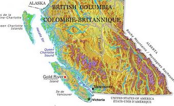
St. John's, NL, incorporated as a city in 1921, population 110,525 (2021 census), 108,860 (2016 census). The capital and largest city of Newfoundland and Labrador, the city of St. John's is located on the eastern side of the Avalon Peninsula of southeast Newfoundland. Its landlocked harbour is approached through a long, narrow channel and is protected by the high hills on which the city is built. The origin of the name St. John's is not known, but its use appears on a Portuguese map by Pedro Reinel (1516–20) as "Rio de San Johem" and later, in a 1527 letter by the English seaman John Rut, as the "Haven of St. John's." According to popular folklore, however, the city takes its name from the feast of Saint John the Baptist and the arrival of Italian explorer Giovanni Caboto (John Cabot) on the shores of Newfoundland on 24 June 1497.
Settlement
Indigenous Peoples
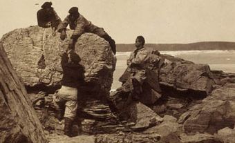
The now-extinct Beothuk were Indigenous peoples in Newfoundland. In the spring and summer, the Beothuk lived along the coast of Newfoundland where they fished, hunted sea mammals such as seals, and collected shellfish and birds’ eggs. During the autumn and winter, the Beothuk moved to the interior where they hunted caribou. There are no known archeological Beothuk sites in the St. John's region, but archaeological findings at Ferryland on the eastern side of the Avalon Peninsula and on the Avalon's isthmus suggest that the Beothuk probably once lived or hunted on the Avalon.
European Settlement
By the early 16th century, St. John’s was frequented by European fishermen. In 1527, English sailor John Rut reported finding Norman, Breton and Portuguese ships in St. John’s harbour. By 1583, when Sir Humphrey Gilbert arrived in St. John's to declare Newfoundland officially an English colony, settlement had developed on the central and eastern sections of the north side of the harbour. By the middle of the 17th century, St. John’s was the major administrative and supply centre for the Newfoundland fishing industry. The population of St. John’s swelled temporarily each summer with the arrival of migratory fishermen, but the town’s permanent population remained small until the start of the 19th century. The administration of St. John’s and the Newfoundland colony was conducted by fishing admirals and, after 1729, by appointed governors. Both the admirals and the governors, however, resided in St. John’s only during the fishing season and returned to England during the winters. The provision of aid during disasters or times of need was carried out by the local military garrison which was stationed year round at Fort William. In the early 1720s, the town’s permanent residents established their own magistrate system to govern during the winter months. The authority of these magistrates was subsequently confirmed by the colony’s governor in 1729.
The establishment of European coastal settlements such as St. John’s forced the Beothuk to move into Newfoundland’s interior, denying them access to the maritime resources which they had relied on for sustenance. Starvation due to the more scarce resources of the interior, conflict with European settlers and the introduction of European diseases such as tuberculosis decimated the Beothuk population. In 1829, Shawnadithit, the last known Beothuk, died in St. John’s of tuberculosis.
Development
From the middle of the 18th century to the end of the Napoleonic Wars in 1815, the population of St. John’s grew from less than 1,000 permanent residents to over 10,000. As a result, in 1817, St. John’s received its first year-round governor, replacing the winter magistrate system established in the 1720s. In 1832, St. John’s was granted a colonial legislature by England.

The city was destroyed by fires in 1816, 1817, 1819, 1846 and 1892. After 1870, small manufacturing industries were established in the capital. A dry dock opened at the port in 1882 and, after 1898, the city became the headquarters for the trans-island railway, which had been completed across Newfoundland by Canadian railway entrepreneur Sir Robert Reid the previous year. After 1900 an improved coastal boat service to the outports further enhanced the pre-eminence of St. John's.
Poor world markets for Newfoundland fish following the First World War led St. John's into a recession, which was further worsened by the Great Depression. Despite the negative effects of the Depression, the population of St. John’s grew during the 1930s as people moved from Newfoundland’s outports to the city seeking work. Prosperity returned during the Second World War with the arrival, in January 1941, of the US armed forces to build Fort Pepperell and other military facilities in the capital. The resulting construction boom continued after 1946 with the building of new suburbs and the large infusion of federal funds after Confederation in 1949. St. John's became more dependent after 1949 on public sector employment; at the same time it lost its traditional role as the fish-export centre of Newfoundland with the withdrawal from the salt-fish trade of major city mercantile firms, which chose to concentrate on a growing wholesale consumer trade.
The port of St. John's has been transformed from an import-export centre into an import-service centre, as much of the port's revenue until the 1980s was generated from supplying and repairing the local and international fishing fleet. The city has excellent air and road connections with both the rest of the province and the Canadian mainland. Close proximity to oil discoveries on the Grand Banks and the development of major oil fields in the 1990s have significantly boosted the city's economic and physical development.
Cityscape
St. John’s is one of the oldest and most easterly cities in North America.
Before Confederation the streets were narrow and winding, which reflected the city's system of land tenure. British absentee landlords owned much of the land in the main commercial-residential area and with the government financially unable to acquire that land following the fires in 1846 and 1892, they never imposed straight, wide streets in a gridiron pattern. The city’s street patterns, as such, maintained a “helter-skelter” appearance.
The major feature of the St. John's landscape in the harbour front business district was the numerous private finger piers that jutted out from the merchants' warehouses on the south side of Water Street. The city's streets ran in an east–west direction and parallel to the harbour. In 1964, the federal government completed a 915 m wharf along the north side of the harbour.
Suburbs expanded into the valleys west, north and northeast of the principal settlement following the creation of the St. John's Housing Corporation in 1944. The spread of industry followed throughout the adjacent harbour area. Since the 1960s, new suburban industrial parks have been created to accommodate existing industry and for the economic activity generated by offshore oil development. In 1992, the city underwent a process of amalgamation with neighbouring areas, including Wedgewood Park, Portugal Cove-St. Philip’s and Goulds, and expanded its boundaries. Most of the area was made up of the three large watersheds of the Regional Water Supply System, which transferred control of the region's water supply to the city.
Architecture
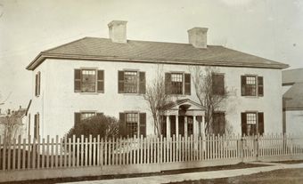
In the 16th and 17th centuries, architecture in St. John’s followed the tilt, or log cabin, form. The Georgian style of the hip or cottage roof, simple symmetry and classical form predominated among the 2½-storey frame buildings until the 1846 fire. The “Great Fire” of 1892 destroyed 2,000 houses and left a large portion of downtown St. John’s in utter ruin. Post-fire reconstruction brought along new architectural styles including Gothic revival, Queen Anne and Second Empire, which was especially dominant. Notable 19th-century buildings include the Colonial Building (classic revival), the Roman Catholic basilica (Romanesque) and the Anglican cathedral (Gothic revival). The second bishop of Newfoundland, Edward Feild, commissioned English architect George Gilbert Scott to design the Anglican cathedral of St. John the Baptist.
Since the mid-1960s, hotels, banks and office buildings have been added to the city skyline. Strict heritage regulations, however, dictate the pattern of development and redevelopment, including the height of buildings, which has helped maintain much of the city’s original character. Confederation Building (1960), home of the Newfoundland and Labrador House of Assembly, is the tallest building at 64 m. The hilly landscape and colourful building facades led one New York Times travel writer to describe it as a “smaller but earthier San Francisco.”
Institutions
St. John's is home to most of Newfoundland's social, educational and religious institutions. The Benevolent Irish Society and the Convent of the Order of Presentation Sisters date from 1806 and 1833, respectively. The city is also the site of Memorial University (established in 1925), the College of the North Atlantic (formed in 1997 from five separate colleges) and the Fisheries and Marine Institute (established in 1964).
In 2001, the city erected 6,000-seat hockey arena and attached convention facility. In 2005, an archives-museum-art gallery complex (The Rooms) opened near the basilica, having a commanding view of the city and its harbour. A number of the older buildings in the city's downtown have been redeveloped as private condominiums and other lands in the area have been developed for this purpose, reflecting the city's new wealth generated by offshore oil production.
Population
St. John’s experienced slow growth until the Napoleonic Wars, when substantial Irish Roman Catholic immigration increased the population from 3,742 residents in 1796, to 10,018 in 1815. After 1832, natural increase and the migration of outport residents to the capital combined to produce steady growth and a compact, ethnically homogeneous community of Irish and British. Although Roman Catholics ceased to form a majority of the city’s population after 1911, their influence in the social, cultural and political life of St. John’s was well entrenched. According to the 2021 census, Roman Catholics comprise 38.5 per cent the population of St. John’s, followed by members of the Anglican and United Churches, and those claiming no religious affiliation.
The steady population increase produced serious social problems of public health, housing and unemployment that were only partly relieved by immigration to the northeast US and elsewhere in Canada. The city's population doubled from 1946 to 1971 as large numbers of people came to St. John’s to participate in new employment opportunities in the civil service and service sectors. However, after 1971, St. John’s experienced a decline (except for the new residents acquired through the 1992 annexation), as many residents moved to Mount Pearl and other new suburban communities outside the city boundaries.
St. John’s population is still predominantly Anglo-Saxon and Irish. According to the 2021 census, people citing English origins make up the largest ethnic group, at 36.6 per cent of the population, followed by Irish (34 per cent) and Canadian (18.5 per cent). Visible minorities account for 10.1 per cent of city residents, with South Asian, Chinese, Black and Arab people comprising the largest communities.
Economy and Labour Force
After Newfoundland and Labrador joined Confederation in 1949, the entry of cheaper Canadian manufactured goods into the province caused the city's industries to collapse and thereby reduced the volume of commercial activity at the port. The completion of a paved highway across the island in 1965 enabled mainland distributors to bypass St. John's, and use Corner Brook and Channel-Port aux Basques to send their goods to island centres. The federal government’s 1992 moratorium on the northern cod fishery, owing to the severely depleted cod population, also had a negative impact on the city’s economy.


Since 1997, however, the growth of the offshore oil industry has been a boon to the local economy. As well, in 2010 ExxonMobil Canada moved its headquarters to St. John’s, while several other international oil companies maintain operations in the city. Since 2000, tourism has increased substantially with several major new hotel facilities and with major cruise ship lines regularly visiting the city. With partnerships among private industry, academic institutions and various levels of government, the oceans technology sector is an increasingly important part of the local economy.
The growth since 1949 of a large civil service supported by the federal, provincial and municipal governments has been the key to the expansion of the city's labour force and to the stability of its economy, which supports a sizable retail, service and business sector. The largest portion of St. John’s labour force is employed in health care and social assistance, followed by retail trade, public administration, educational services, and accommodation and food services. The largest individual employers in the city are Eastern Health, the provincial and federal governments, and Memorial University. The growth of the university has also played a large role in the city's becoming more culturally and ethnically diverse. In 2013, about one quarter of students enrolled at Memorial University came from outside the province.
Transportation
In response to the threat of German air raids during the Second World War, the Canadian government approved plans for an airbase near St. John’s in 1939, and construction began in the community of Torbay in 1940. The facility came under civilian operation in 1946, but maintained strong military ties throughout its operations.
In 1898, the Reid contract established the terms under which the Reid Newfoundland Company and Robert G. Reid would operate the Newfoundland Railway system. This agreement also stipulated that roads be paved and introduced electric streetcar service to the city. The first streetcar ran on 1 May 1900. These streetcars required a great deal of power to operate, so the St. John’s Street Railway Company was granted permission to build a hydro-electric generating station at Petty Harbour Long Pond from which it would derive power. After 1924, Montréal Engineering, owned by the Nova Scotia-born businessman Izaak Killam, took over ownership and operations. The lines were abandoned in 1948 as automobiles eclipsed streetcar service.
In 1939, a private bus service started operations to serve the suburbs. In 1949, unionized workers of the Nova Scotia-owned Golden Arrow Coaches Limited went on strike and, when the company refused to meet the city council's demands for an improved service, the city council revoked the company's operating charter. In 1950, a 20-year franchise was given to a company owned by Montréal and Toronto interests. In 1957, Capital Coach Lines Limited found itself unable to meet the demands of its unionized staff in a threatened strike and city council revoked the company's franchise rather than risk a disruption of service. In late 1957, the city council purchased the assets of the company and began operation of a public transportation system, which now operates under the Metrobus brand.
St. John’s is the eastern-most point of the Trans-Canada Highway.
Communication
The Telegram is the city’s only daily printed newspaper, which also offers its readers a daily online edition. In 2005, the National Post stopped distributing print versions of their newspapers to the province owing to rising shipping costs and low sales, and in 2013 the Globe and Mail followed suit.
Between 2003 and 2008, The Independent served as the city’s only independently-owned media outlet. The publication folded, but was given new life as an online publication in 2010. It features opinion pieces along with local arts, culture and lifestyle coverage. The Overcast, now in its second year, is an alternative magazine focussing on the arts and cultural scene.
Government and Politics
The colonial government governed the city until 1888, when it received a limited form of self-rule with authority over the water supply, streets, sewers, parks and building regulations. The city was governed by different councils or commissions composed of government-appointed members and elected officials. In 1916, a fully elective form of municipal council was established.
In 1921, the legislature passed a comprehensive bill, which was drafted by the commissioners who had administered the city from 1914 to 1916. This 1921 Act and its subsequent amendments by the legislature are the basis of the St. John's city government.
In 1969, the number of elected councillors increased from six to eight. In 1981, the city adopted a partial ward system. Since amalgamation in 1992, the voters of St. John's elect four councillors at large, five councillors on the basis of the ward system, a deputy mayor and a mayor. All members of council serve four-year terms.
The St. John's metropolitan area has no regional government, but services such as fire protection and water are provided and maintained by the city with some surrounding municipalities having both financial and administrative inputs into their operation. In 2009, St. John's also instituted a new sewage treatment plant designed to clean up the harbour waters.
Cultural Life
Historic Sites and Museums
Signal Hill National Historic Site, which contains Cabot Tower, was conceived in 1897 to commemorate the 400th anniversary of Cabot’s arrival on the shores of Newfoundland and Queen Victoria's Diamond Jubilee. Opened in 1900, the tower also served as the site for Guglielmo Marconi to receive the first transatlantic wireless message in 1901. Located on the slope of the hill is the popular Johnson Geo Centre, a museum devoted to the geological history of the province.
Since 1978, the city has celebrated St. John’s Day (June 24), though the holiday is called “Discovery Day” in the rest of the province, as a civic holiday in honour of Newfoundland's discovery in 1497.


In 1919 the city was the starting point of the first transatlantic non-stop airplane flight, when Sir John Alcock and Arthur Brown flew to Ireland. The Railway Costal Museum, located in the old railway station on Water Street, is devoted to the history of Newfoundland's railway and coastal boat services. Commissariat House and the Colonial Building are provincial historic sites. St. John’s is also home to the Provincial Museum of Newfoundland and Labrador, the Arts and Culture Centre, and the Resource Centre for the Arts.
Sports
The city has a long tradition in sports. The annual Royal St. John’s Regatta, held on the first Wednesday in August, dates from about 1818 and is the oldest continuous sporting event in North America. St. John's was the site of the 1977 Canada Summer Games, which left the city with improved sporting facilities. A minor league farm team of the Toronto Maple Leafs, the St. John's Maple Leafs, played in St. John's until 2005. The St. John's Fog Devils of the Québec Major Junior Hockey League briefly replaced the Maple Leafs (2005–08). The St. John’s IceCaps, members of the AHL, are the minor league affiliate of the Winnipeg Jets.
Festivals
Since 1984, the city’s entertainment district, located on George Street, hosts an annual music festival that precedes the Royal St. John’s Regatta. The Newfoundland and Labrador Folk Festival is one of the largest festivals in the province. First held in 1989, the St. John's International Women's Film Festival is one of the longest-running events of its kind in the world.
Parks
The city’s natural landscape makes it an ideal locale for whale watching, observing marine birds and boat tours. The Grand Concourse is a network of trails leading through national and provincial parks as well as heritage sites. The city is also home to three urban parks: Pippy Park, Bowring Park and Bannerman Park.