Article
Arctic Archipelago
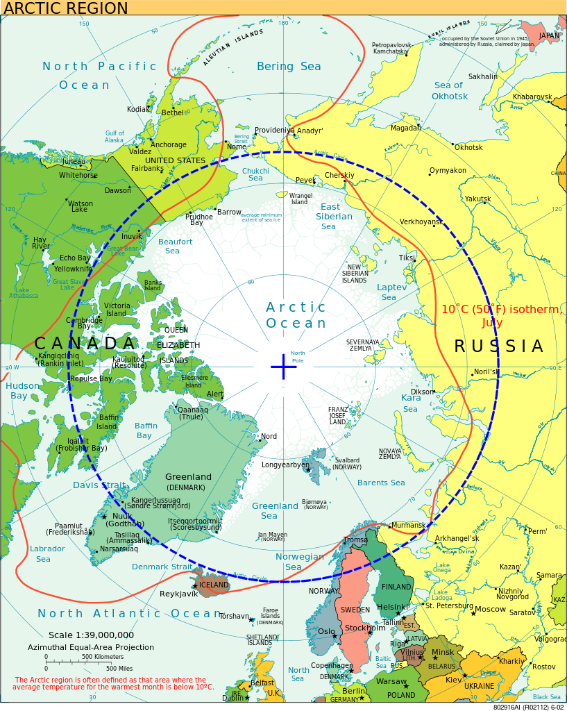
Lying north of mainland Canada, the Arctic Archipelago consists of 94 major islands (greater than 130 km2) and 36,469 minor islands covering a total of 1.4 million km2. Apart from Greenland, which is almost entirely ice covered, the Canadian Arctic Archipelago forms the world's largest High Arctic land area.